LOWS TONIGHT: MID-UPPER 50s
HIGHS FRIDAY: LOWER 80s
DISCUSSION
The large upper-level low that provided our early taste of winter will begin to lift away in the coming days.
A ridge of high pressure will subsequently build in and replace it.
As a result, we are looking at milder nights and warmer days as we round out the week and head into the weekend.

In fact, lows tonight will be considerably milder in the mid-upper 50s.

And believe it or not, highs will push the lower 80s Friday afternoon under mostly sunny skies.

As high pressure at the surface shifts eastward, more of a southerly breeze will begin to kick in (10-15 mph).
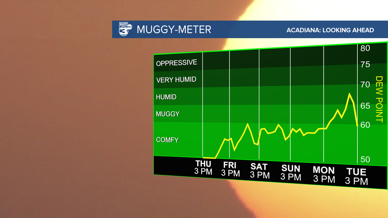
That same breeze will also help to increase the low-level moisture, so you'll definitely notice an increase in the humidity... especially for the weekend and into Monday/Tuesday of next week.

All of this will be ahead of another cold front that looks to push through late on Tuesday and into early Wednesday.
This front does promise to bring a decent chance of scattered showers and storms along with it, and we can certainly use the rainfall.
We won't see nearly as much of a drastic cool down as we saw with this previous front, but still slightly cooler, more comfortable conditions will work in for the mid-latter parts of next week.
Be sure to check the katc weather page for the latest 10-day forecast.
Have a great rest of the week!
------------------------------------------------------------
Stay in touch with us anytime, anywhere.
To reach the newsroom or report a typo/correction, click HERE.
Sign up for newsletters emailed to your inbox. Select from these options: Breaking News, Evening News Headlines, Latest COVID-19 Headlines, Morning News Headlines, Special Offers


