

On Wednesday the discussion was about how Fred was going to look when it crossed over Hispaniola and the mountains terrain really treated Fred poorly.
While Fred is still considered a tropical depression its center of circulation has been completely exposed, and will be vulnerable to the influence of dry air and wind shear.
This goes along with what models had projected and the question now is will the storm be able to get its act together and find a way to restrengthen into a tropical storm.

All of the major models still believe that Fred will eventually regain some structure and eventually could become a tropical storm in the eastern Gulf of Mexico, although the current look does take out the possibility of a hurricane or even a strong end tropical storm.
The National Hurricane Center remains conservative in it's approach to Fred and keeps it a tropical depression through its grazing of Cuba before slowly strengthening it back into a tropical storm.
As models trend toward a weaker storm though there is the possibility that it just remains an open wave, especially if it moves north before getting to the Gulf of Mexico, which is accounted for in the cone of uncertainty.
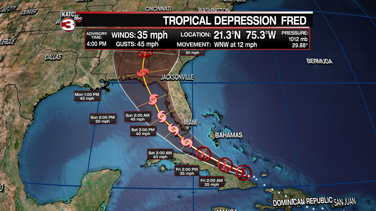
Regardless, this looks like a rain make for Florida and folks along the western peninsula likely have a wet series of days ahead of them.
There remains no change to the belief that this is not going to impact Louisiana and will remain far to our east.

Following right behind Fred is an organized wave which is showing signs that it may be given a name sooner rather than later, when this happens the next name will be Grace.
There's not much consensus with regards to the long range forecast of this wave, and we find ourselves in the "wait and see" period of monitoring a particular tropical system.
A few models do develop this storm eventually into a tropical storm, but none so far bring it into the Gulf any time soon, if at all.
There really isn't much point in speculating the long term forecast with this one because of all the unknowns but it'll be something to keep an eye on over the next few days.
------------------------------------------------------------
Stay in touch with us anytime, anywhere.
To reach the newsroom or report a typo/correction, click HERE.
Sign up for newsletters emailed to your inbox. Select from these options: Breaking News, Evening News Headlines, Latest COVID-19 Headlines, Morning News Headlines, Special Offers
