


Winter has arrived in Acadiana as temperatures have dropped and gray skies have moved in for the weekend.
This is round one, the main event is still set for Monday with winter precipitation looking increasingly likely and followed immediately by extreme cold Tuesday morning.
While confidence is growing there are still some finer details that need to be ironed out, and even though that may sound minor with a forecast like this finer details are very important.
The last few days we've talked about the discrepancy between the two major models, the GFS and EURO, and some of those discrepancies still exist but they do seem to be coming together.
So let's go through the range of possible outcomes and sort out what is the most likely scenario for Acadiana and how that could impact us for the start of next week.
As has been the case all week long the EURO remains the milder of the two, that's not to say that it is warm or mild, but it is the least problematic of the two possible scenarios.
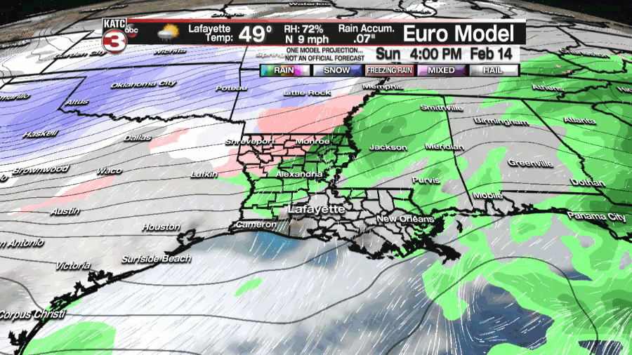
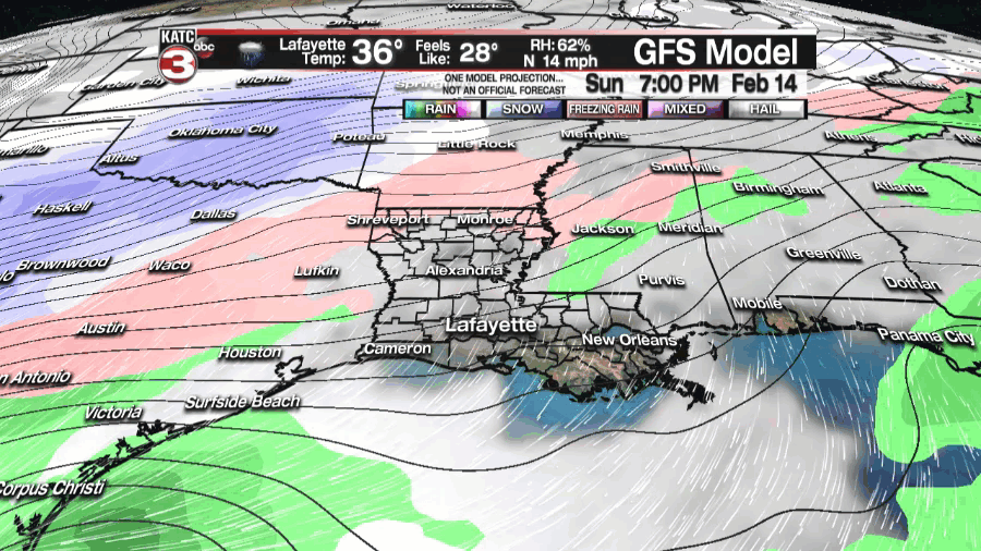
There are a couple of take-aways from comparing the two models as they both initiate showers at relatively the same time, with rain getting going Monday morning and lasting through the day.
The temperatures at the time of precipitation is going to be the biggest detail to iron out as that will determine the type of precipitation we receive, either freezing rain or very cold rain.
It looks increasingly likely that we will get some frozen precipitation and once we get an idea of the timing of the on-set of freezing rain we can get a much better idea of impacts.
The EURO still hints at the freezing rain switching briefly over to snow Monday evening but it will be tough to see that happen so I believe it will stay mostly ice.
While the GFS has the boundary between the liquid rain and freezing rain just offshore all of Acadiana (with the exception of the coastline) would be on the hook for ice, however, if that boundary is slightly more north the freezing rain would be limited to the northern half of Acadiana until later in the evening.
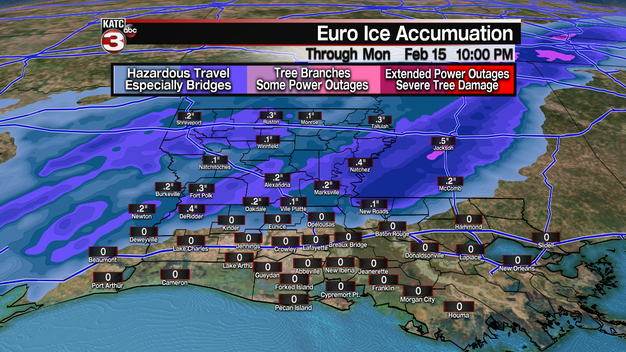
The two above graphics is a good illustration about how those small differences can lead to massive differences in impacts, the EURO barely has any accumulation of ice while the GFS is sitting in the half inch range.
Accumulation between a quarter and half inch can be incredibly disruptive, this is the range that you can start to see power outage and weakened branches falling under the weight of ice, so stating the obvious the longer the event goes on for the more impacts there will be.
Based on this forecast I would expect travel on Monday to be impacted, especially Monday afternoon through the overnight hours, bridges and overpasses will be the first to become dangerous and it won't be surprising to see numerous road closures.
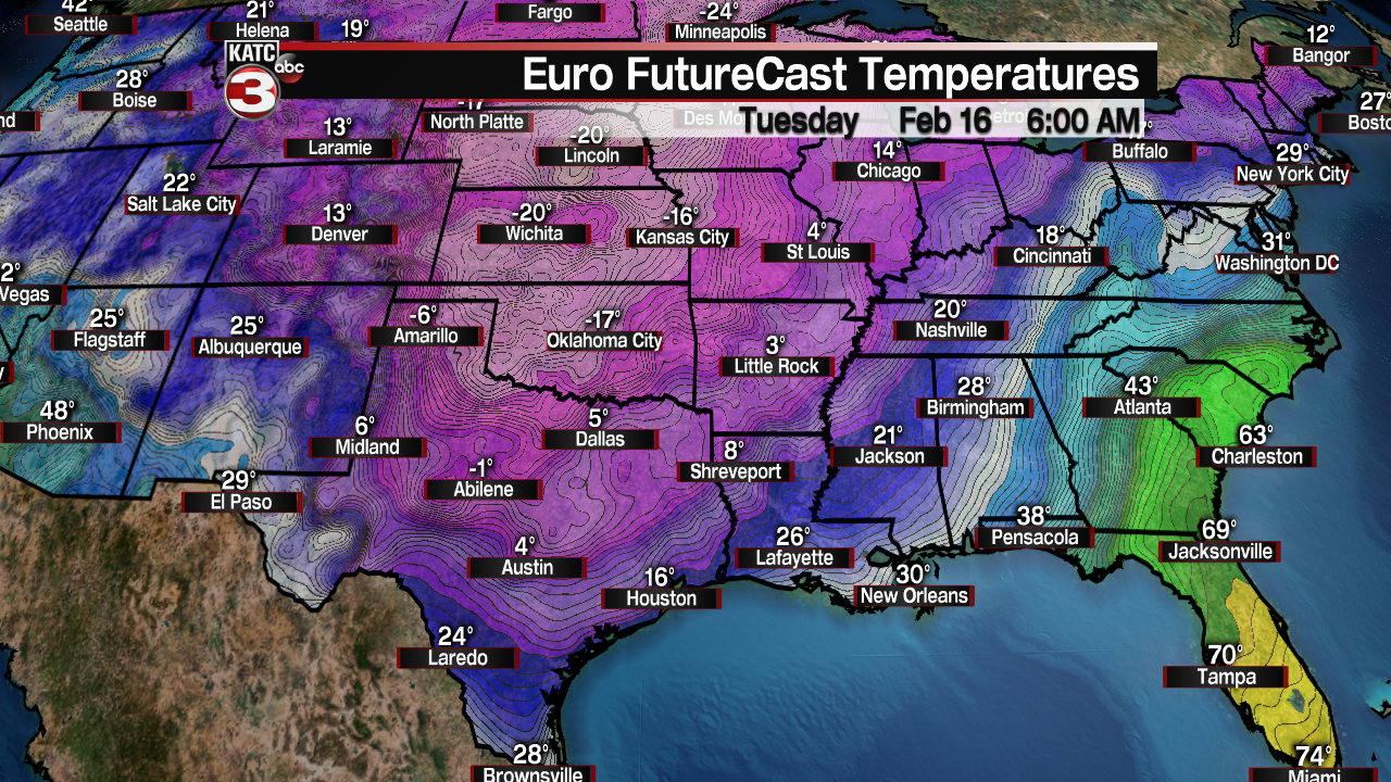
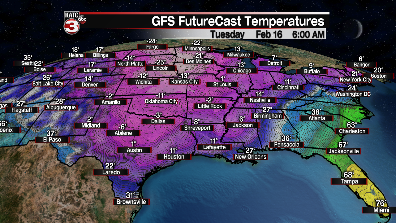
The extreme cold is looking to settle in Tuesday morning and the range seems to be in the mid/upper teen to the low 20s with the wind chill down in the low teens to single digits.
This is cold that is dangerous to be out in, so check on your neighbors especially if they don't have heat.
Since the temperatures will be so cold any ice that accumulates won't melt so travel will arguably more treacherous on Tuesday morning.
------------------------------------------------------------
Stay in touch with us anytime, anywhere.
To reach the newsroom or report a typo/correction, click HERE.
Sign up for newsletters emailed to your inbox. Select from these options: Breaking News, Evening News Headlines, Latest COVID-19 Headlines, Morning News Headlines, Special Offers
