LOWS TONIGHT: MID-70s
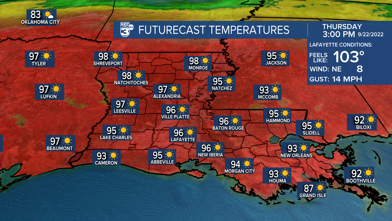
HIGHS THURSDAY: MID-90s
DISCUSSION
Before we dive into things... what month is it again? Whew, it's been hot out there y'all!
And the heat is not going anywhere for the remainder of the week and into the weekend as the upper ridge hangs tough.

Expect mostly sunny/partly cloudy days as highs continue to push well into the mid-90s.

Be sure to remain hydrated if you have to be outdoors!
Rain will be slim to none over the next several days as well, although a few isolated showers could enter the equation by Sunday and Monday as a drying front pushes through.
At the very least, it would help to give us more pleasant nights overall.
The end of next week's forecast will be dependent on the tropics.
Be sure to see my latest tropical discussion below!
TROPICS
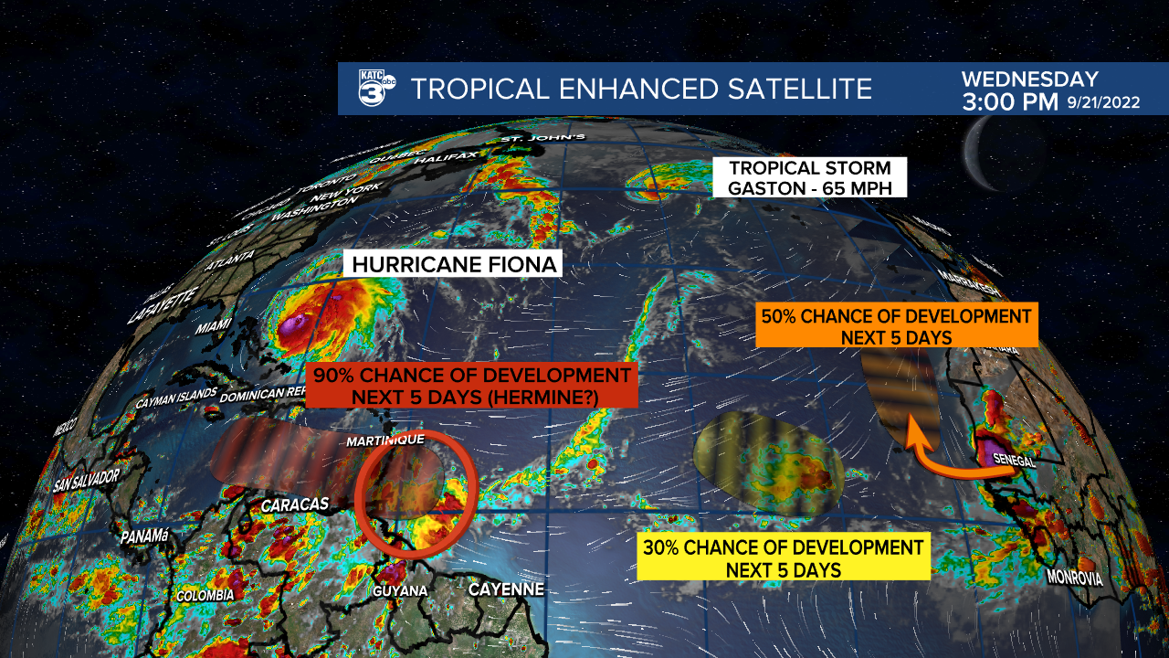
There are currently five features out in the Atlantic basin.

Fiona and Gaston will continue to stay well away from us.
Meanwhile, the area of interest that has everyone talking is designated as Invest 98L out in the extreme eastern Caribbean.
Let's get right to the point. This is likely to become the next named system (and probably hurricane) of the season.

If so, the name would be Hermine or Ian. Why? Well because it will be tracking into a very favorable environment consisting of low wind shear + warm sea surface temperatures in the days ahead.

With that said, it is still entirely too soon to say where it will end up in the long run simply because a center of circulation has yet to form!
However, for those wondering, the eventual *possible* track will all be dependent on the timing of an approaching trough late next week.

Euro has been consistent with a west Florida landfall while the GFS has been a little farther west.
Bottom line: We continue to wait and watch. Nothing pending thru this weekend. Hot and mostly sunny weather continues...
------------------------------------------------------------
Stay in touch with us anytime, anywhere.
To reach the newsroom or report a typo/correction, click HERE.
Sign up for newsletters emailed to your inbox. Select from these options: Breaking News, Evening News Headlines, Latest COVID-19 Headlines, Morning News Headlines, Special Offers


