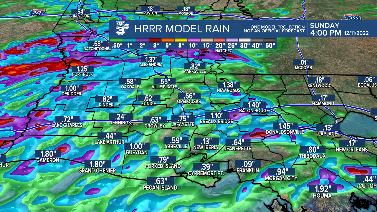
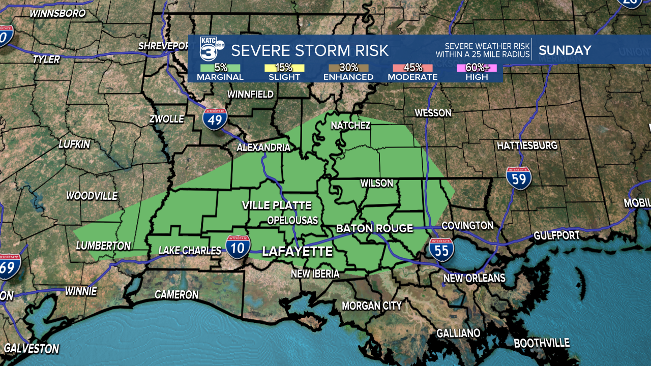
A subtle disturbance will traverse the area tonight and into Sunday helping to increase rain chances.

Showers and storms will be most likely after 3am tonight thru much of our Sunday morning.

Most areas can expect to pick up around 0.50"-1.00" of rainfall with locally higher amounts possible in heavier storms.

There is a low-end risk of a couple isolated storms that could produce strong wind gusts (level 1).

We'll remain seasonably warm to round out the weekend as highs settle into the mid-70s.
Stronger front arrives late Tuesday and then we're looking at a big pattern flip for the middle and latter parts of the month.
Stay tuned!
------------------------------------------------------------
Stay in touch with us anytime, anywhere.
To reach the newsroom or report a typo/correction, click HERE.
Sign up for newsletters emailed to your inbox. Select from these options: Breaking News, Evening News Headlines, Latest COVID-19 Headlines, Morning News Headlines, Special Offers

