


Chilly tonight as most of us will dip into the 40s.
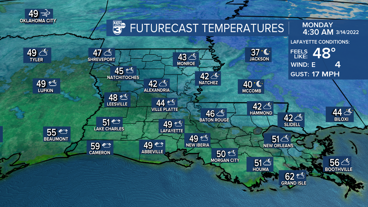
Readings will actually rise into the 50s closer to daybreak as clouds begin to build in.
We're looking at a mostly cloudy Monday as highs top out in the upper 60s to near 70° in spots.
A few light showers could be possible throughout the day (30%).
Better rain and storm chances arriving late Monday night as an upper-level disturbance swings through.
There is a low-end risk of severe weather.
Damaging winds and hail will be the primary threat as the complex of storms roll through.
Heavy rain will be possible at times as well.
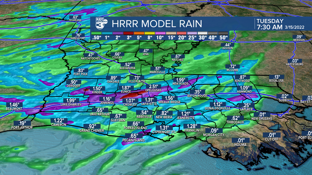
The short-range models are showing a decent soaking across the area (1-2 in).
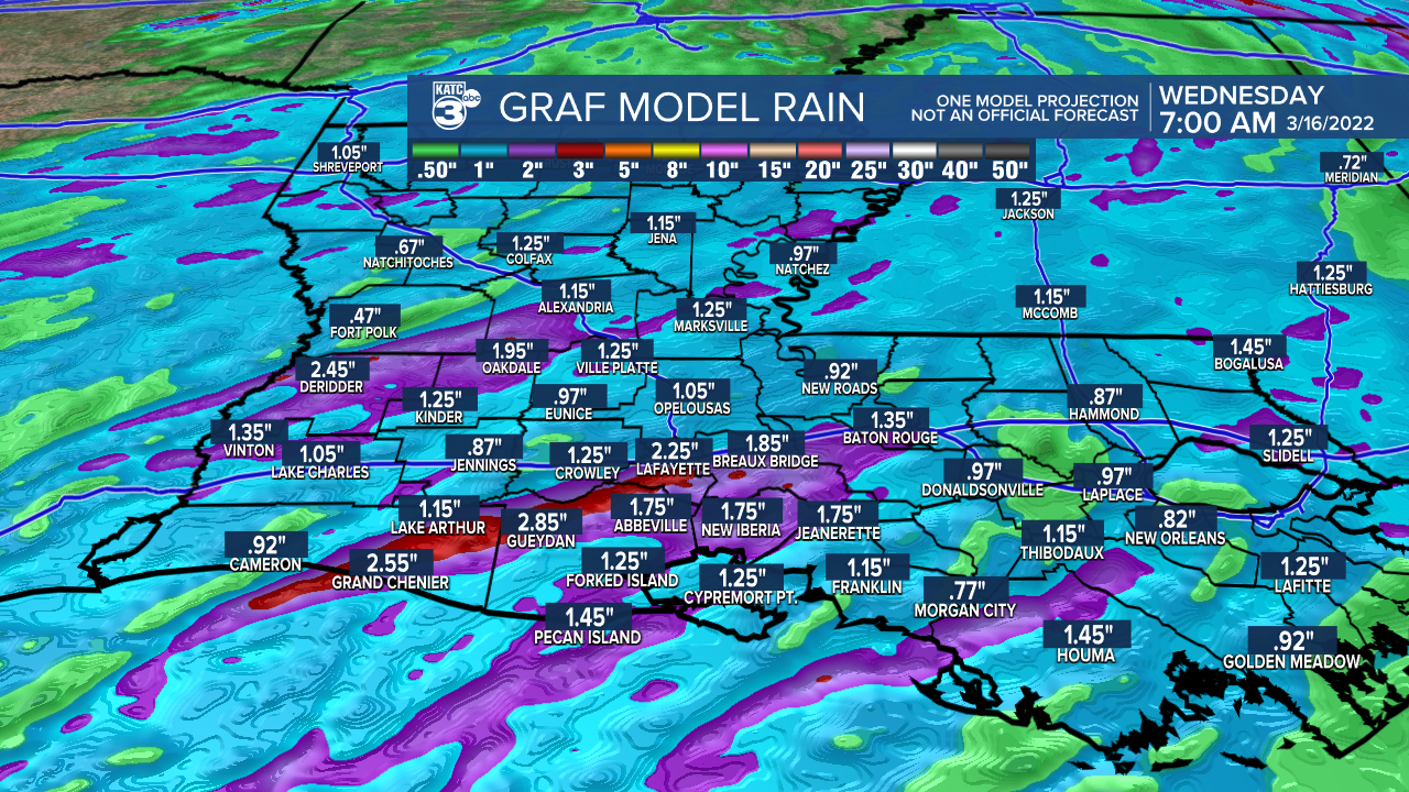
We'll certainly take it considering we've been so dry the last few months!
The bulk of the activity will begin pushing eastward into Tuesday morning
We should squeeze out some sunshine Tuesday afternoon as temperatures push the low-mid 70s.
So, no cooler weather behind this system.
In fact, we'll stay mild for the rest of the week.
Next best rain chance arrives Friday (as of now, morning hours on Friday).
That looks to set up a pretty nice and mild following weekend!
Have a great week!
------------------------------------------------------------
Stay in touch with us anytime, anywhere.
To reach the newsroom or report a typo/correction, click HERE.
Sign up for newsletters emailed to your inbox. Select from these options: Breaking News, Evening News Headlines, Latest COVID-19 Headlines, Morning News Headlines, Special Offers
