

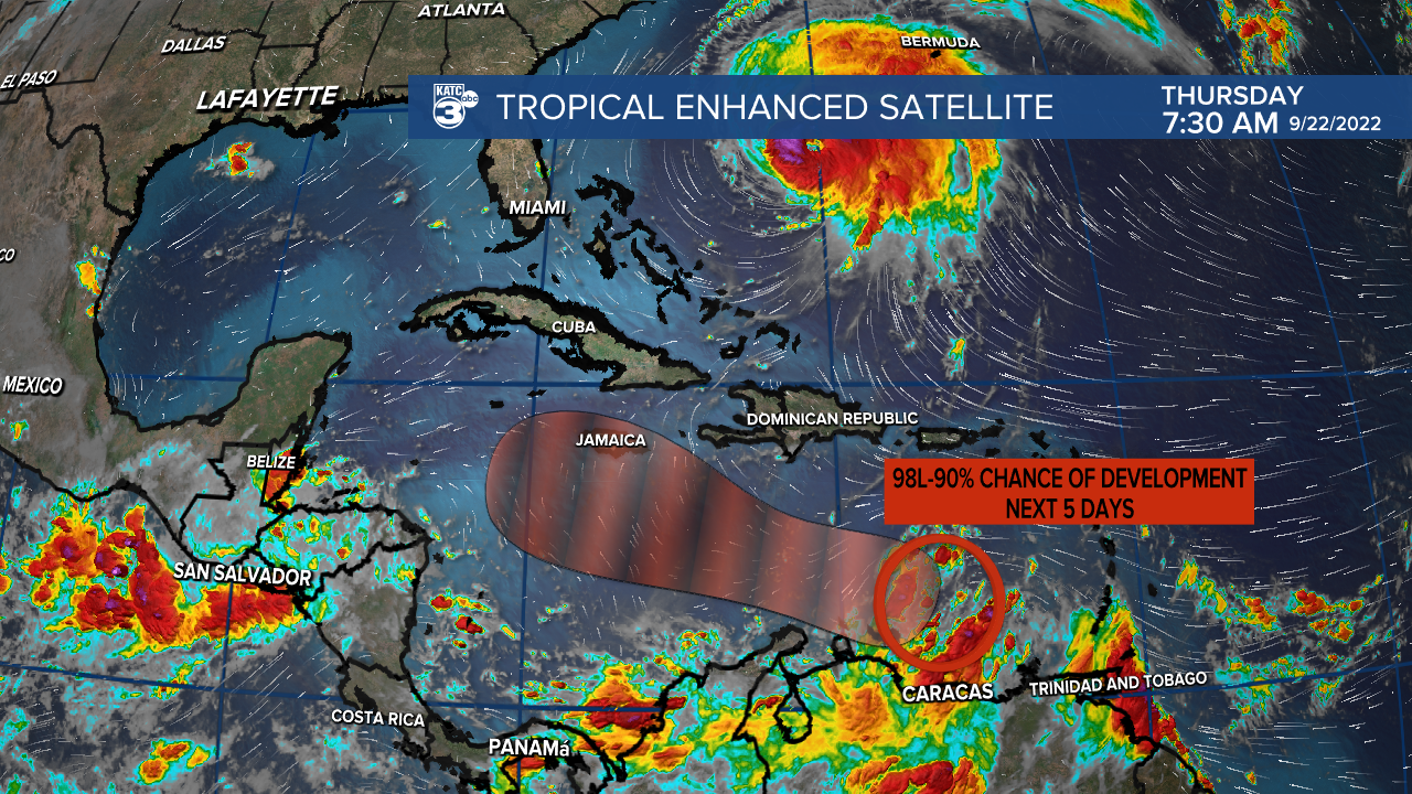
Residents across the Gulf of Mexico are continuing to keep an eye on Invest 98L which will move into an area of favorable development over the next couple of days where it will likely become a named storm.
The National Hurricane Center has given it a 90% chance of development by the end of the weekend, and Hurricane Hunters have started to fly into the system to get as much data from it as possible.
All the usual caveats are in place regarding uncertainty and until we get a firm location of a closed low we will continue to see a lot of volatility from the models, so while they're helpful they should be taken with a heaping of salt.
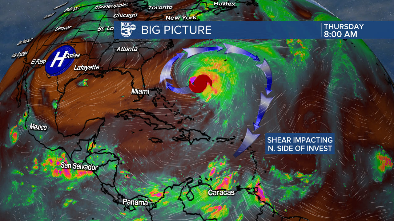
Invest 98L continues to battle with some pretty significant shear from the outflow of Hurricane Fiona, which has hindered it's development over the last few days.
As it drifts west, however, and as Fiona moves north the influence of the shear will weaken which is when we may finally see some consolidation of a low.
All models are in agreement that further development will occur over the weekend as conditions in the central Caribbean sea will be much more favorable then its current area.
It's impossible to say exactly where or when a low will form, but that'll likely be in the area south of the Dominican Republic and could occur as early as Friday morning.
Models still can't come to an agreement regarding this all important step, the EURO seems to now be a little faster and further north than the more southwesterly GFS.

Not having a closed low to focus in on is creating a large amount of volatility in the models which is why the spaghetti track has such a wide range of options.
The reason in the discrepancy is some debate on how and when the turn to the north would occur, the more southern GFS drifts the system way west before it has a chance to turn.
On the other hand, the EURO which is a little more northerly has the storm getting caught up in a digging trough which sucks it up north much quicker bringing it into the eastern Gulf of Mexico.
A more southerly low though may not have the same pull from the trough hence the drift further west.
We also need to see how strong the front will be next week, a weaker front that begins to retreat could end up pulling the storm further west (GFS solution) or a stronger quicker moving front would force the storm east (EURO solution).
This is a long way of saying there's still a lot of questions regarding this storm, and no one from Texas to Florida can start to take their eye off of it as we're all still in play.

We are still very much in the beginning of the forecast process, any impacts wouldn't arrive until late next week so the best course of action now is to review your hurricane plan and keep up to date with the forecast.
This is still the height of the hurricane season so it shouldn't come as a surprise that the Atlantic is show signs of life after a quiet year.
Hopefully by the weekend we will have a better understanding of what we can expect with this storm, and any changes that occur we'll make sure we keep you in the loop.
------------------------------------------------------------
Stay in touch with us anytime, anywhere.
To reach the newsroom or report a typo/correction, click HERE.
Sign up for newsletters emailed to your inbox. Select from these options: Breaking News, Evening News Headlines, Latest COVID-19 Headlines, Morning News Headlines, Special Offers
