


DISCUSSION
Any lingering thundershowers this afternoon will wane as the evening wears on.
Otherwise, expect mild and muggy conditions overnight as lows only drop into the low-mid 70s.
A mostly sunny start to our Saturday will yield to partly cloudy skies by the afternoon.
Highs will push into the low-mid 90s.
A disturbance in the upper levels will ignite storms across Texas and northern Louisiana throughout the day.
That is where storms will have the greatest likelihood of producing damaging winds and hail.
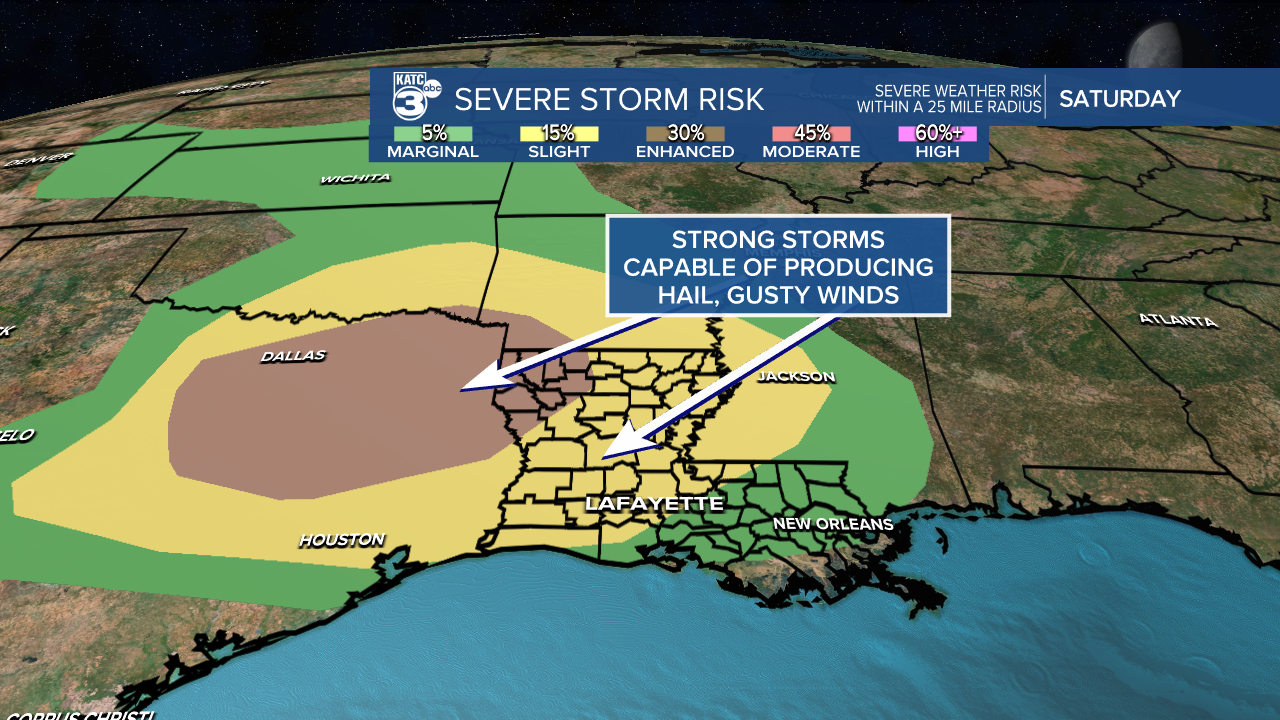
Activity will generally be on a weakening trend as they progress southeastward toward Acadiana into the evening hours.
Still, there is the possibility for a stronger storm or two especially for northwestern Acadiana.
I'm holding rain chances at 30-40%, so not everyone will get in on the rainfall.
Thereafter, the pattern is going to be turning a little drier and hotter as a ridge of high pressure takes control.
Plan on highs planted in the mid-90s with heat indices in the lower 100s for the better part of next week.
Have a great weekend!
------------------------------------------------------------
Stay in touch with us anytime, anywhere.
To reach the newsroom or report a typo/correction, click HERE.
Sign up for newsletters emailed to your inbox. Select from these options: Breaking News, Evening News Headlines, Latest COVID-19 Headlines, Morning News Headlines, Special Offers
