


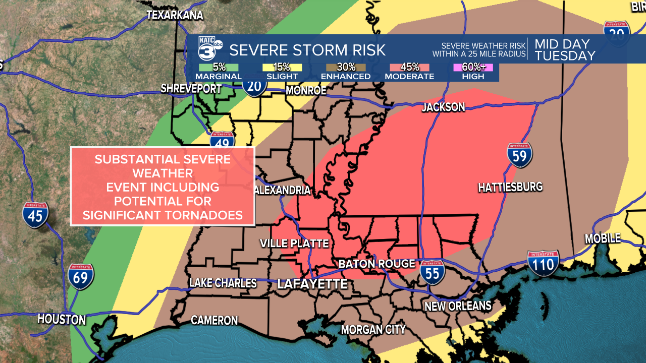
A significant severe weather threat is going to take shape across the Gulf Coast this week, including a potential outbreak of severe weather in Acadiana on Tuesday.
The SPC currently has all of Acadiana with an Enhanced Risk (Level 3/5) with areas north of the interstate with a High Risk (Level 4/5) and has been using strong words typically reserved for high end events.
Weather will deteriorate through the morning with the earliest storms starting to arrive by mid-morning and main line of thunderstorms pushing through in the early afternoon.
The earlier storms will be more discreet and isolated, although the atmosphere will be volatile enough that even a small pop-up shower will have the ability to rapidly flare up into a supercell.
Those supercells will be the types of storms that can produce some of the longer track, more violent tornadoes with the potential for EF-2 or greater, again the SPC is calling for a significant tornado threat (wording reserved for higher end events).

All of Acadiana will have the potential for tornadoes, but the corridor stretching from Evangeline and St. Landry Parish into central Mississippi will be of particular concern.
So as thunderstorms track into that area they will need to be monitored very closely.
The wind threat will be high as well with winds approaching 60 mph in some of the stronger thunderstorms which is certainly strong enough to cause damage.
Monday will be a good day to go through the yard and make sure everything is tied down, and items prone to blowing around are either secured or brought inside.
Hail is also going to be an issue on Tuesday and small to medium sized hail will be possible with some of the thunderstorms.
If it does hail at your house, make note of the date and write it down in the event you have to file an insurance claim for roof damage you can have the information available.

Flooding won't be a major issue, but, we may end up with an inch or two of rain that would arrive very quickly which could put some stress on the roads.
Water could pile up quickly and while it is actively coming down street flooding could be possible, particularly on roads that often struggle with drainage.
Since the system is moving quickly once the showers come to an end we should see water levels quickly start to drain and water receding as quickly as it arrived.
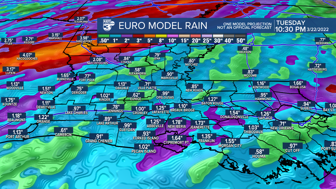
There's going to be a frontal boundary that will lead to some heavier rainfall with several inches of rain likely along that boundary, but that looks like it will be more of an issue in north Louisiana.
Storms will peak in the middle of the afternoon and by the evening the front will be pushing east of Acadiana and the severe threat will be ending.
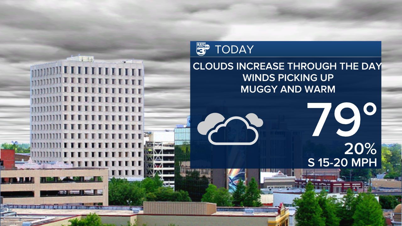
In the meantime, Monday is going to be the set up day as warm, muggy air moves into the area and starting to destabilize the atmosphere.
Highs are going to be in the upper 70s by the afternoon, and winds are going to pick up eventually blowing around 15-20 mph.
It is going to be vital to stay weather aware on Tuesday, so please make sure that you have a way to monitor the weather situation through the day.
If you download the KATC Weather App all of the watches and warning will be sent to your phone, and you'll be able to monitor the forecast.
Keep up to date with the latest information by sticking with KATC both on air and online.
------------------------------------------------------------
Stay in touch with us anytime, anywhere.
To reach the newsroom or report a typo/correction, click HERE.
Sign up for newsletters emailed to your inbox. Select from these options: Breaking News, Evening News Headlines, Latest COVID-19 Headlines, Morning News Headlines, Special Offers
