


DISCUSSION
Showers and storms are on the way for Sunday!
The rain will be heavy at times, and we'll have to keep an eye on training thunderstorms.

I think a decent part of the area can expect to pick up 2-3" but models continue to hint at isolated higher amounts in spots, especially along and north of the I-10 corridor where training appears most likely to occur at this point.
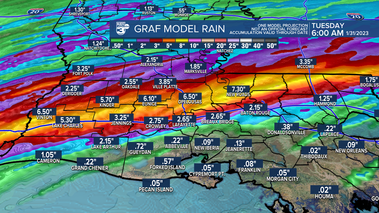
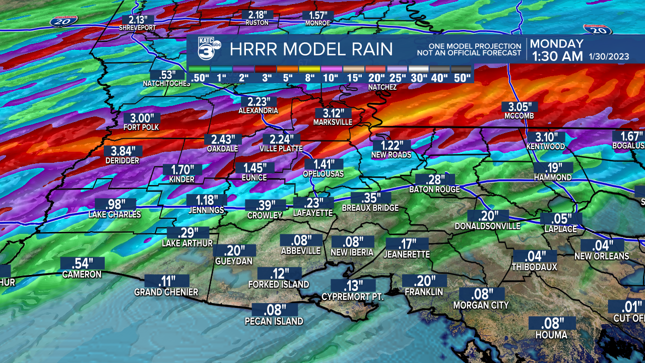
With that in mind and considering our grounds are already saturated, I would not be surprised if we run into some flash flooding issues in some areas.
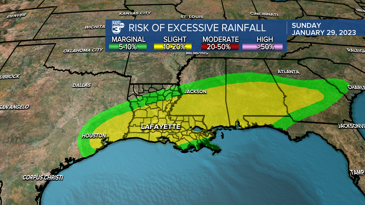
Something we'll monitor throughout the day Sunday.
There is also a low end risk for severe storms.
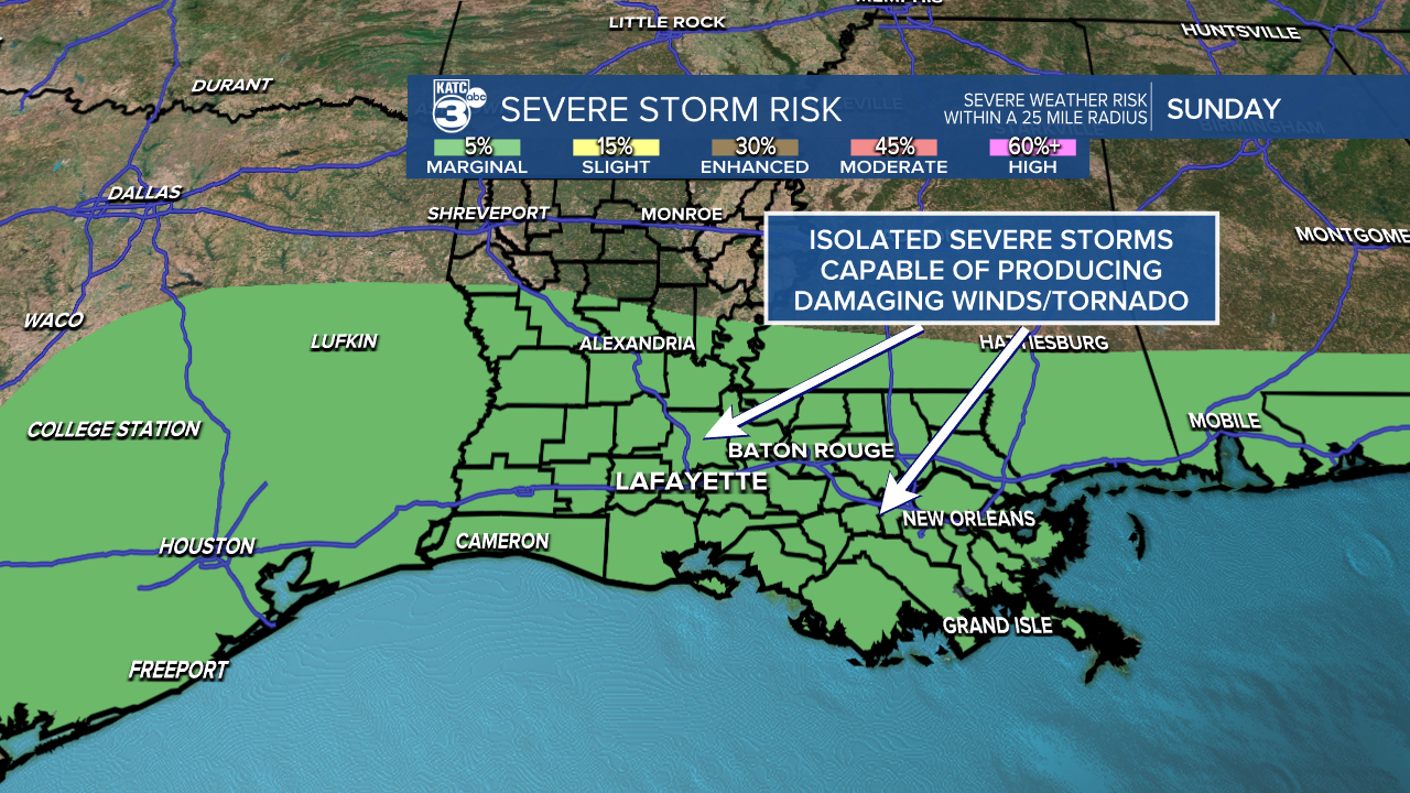
Damaging winds and an isolated tornado can not be ruled out, but the overall threat is pretty low.
The pattern will remain somewhat unsettled for the early parts of the new week as a front gets tangled up and stalls across the region.
Daily, scattered rain chances along with a split in temperatures across Acadiana can be expected.
Have a good one!
------------------------------------------------------------
Stay in touch with us anytime, anywhere.
To reach the newsroom or report a typo/correction, click HERE.
Sign up for newsletters emailed to your inbox. Select from these options: Breaking News, Evening News Headlines, Latest COVID-19 Headlines, Morning News Headlines, Special Offers
