


Rain showers likely this evening as the main push in the upper-levels swings through.

We may hear a few rumbles of thunder, but severe weather is not expected here locally.
Turning windy and much colder tonight into Saturday morning.
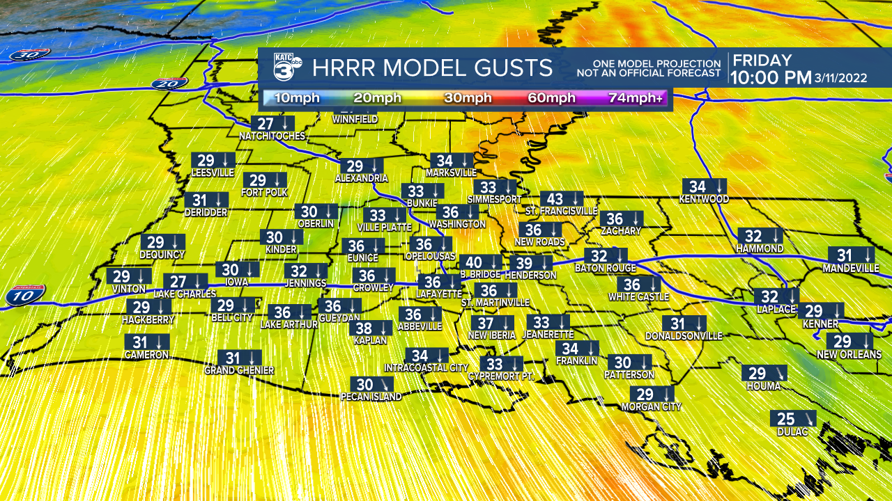
In fact, winds could gust as high as 30-40 mph at times.
Expect those gusty winds to really kick in around 9-10 pm this evening behind the front.
Lows will drop into the mid-30s with wind chills heading for the mid-20s by Saturday morning!

So, be sure to bundle on up if you plan on heading out.
It stays chilly throughout Saturday despite full sunshine.
Highs will struggle to reach the lower 50s, but wind chills will remain in the 40s through the course of the afternoon.
As high pressure settles in across the area Saturday night, winds will begin to relax.

As a result, temperatures will likely drop at or below freezing come Sunday morning.
Plan on a frost, so you'll want to make sure to protect the plants and that the pets have a warm place to stay.
The time will also spring forward one hour early Sunday morning (DST).
Mostly sunny into Sunday afternoon as readings push the lower 60s.
Next chance of rain comes late Monday (Monday night) and into early Tuesday.
Overall, we'll get back to more of a spring-like weather pattern across the area with highs returning to the 70s.
Have a great weekend and stay warm!
------------------------------------------------------------
Stay in touch with us anytime, anywhere.
To reach the newsroom or report a typo/correction, click HERE.
Sign up for newsletters emailed to your inbox. Select from these options: Breaking News, Evening News Headlines, Latest COVID-19 Headlines, Morning News Headlines, Special Offers
