


We've got one more day of warm, muggy weather before we get a chance to cool off a little in time for the weekend.
Clouds will build through the day on Thursday so expect mostly cloudy skies and more moisture comes in off the Gulf of Mexico.
Temperatures, once again, will sit in the low to mid 80s but a steady wind from the south should keep it from feeling to sticky outside.
A front is going to move through late Thursday night/early Friday morning and will provide a round of fast moving showers and a few isolated thunderstorms.
The strongest storms will be the most likely in north Acadiana with damaging wind being the primary issue.
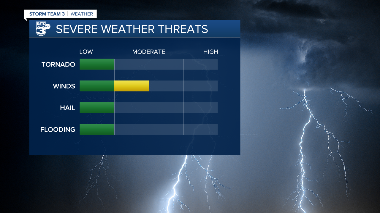
A few isolated tornadoes won't be likely but they will be possible so we'll need to monitor for them through the overnight hours.
The timing of the front will be after midnight, arriving between about midnight and 4:00 a.m. Friday morning.
Much stronger storms will be expected to our north so if you're traveling to Shreveport or areas along the I-20 corridor be very mindful of the weather situation in the northern half of the state.
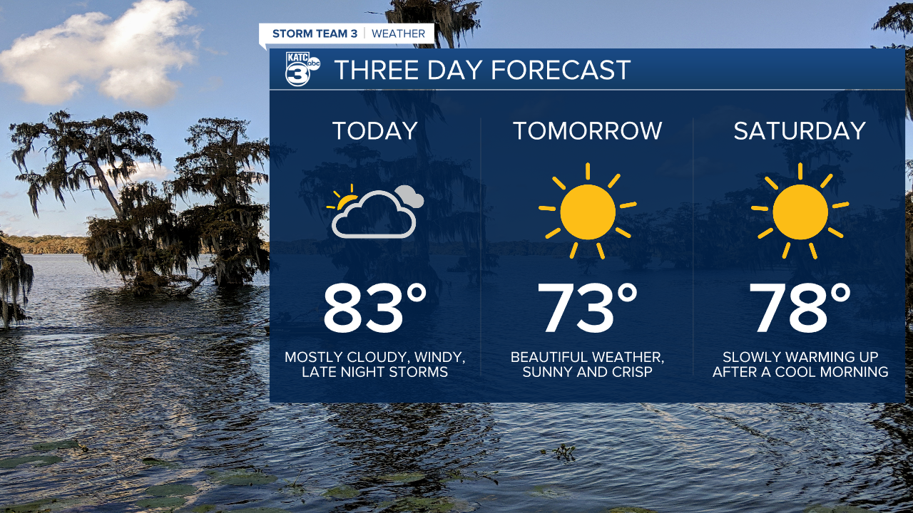
The rest of the forecast looks great, in fact by sunrise Friday the clouds will be gone and we'll be looking at a beautiful weekend.
Temperatures will cool down drastically and the humidity will clear out, it'll stay this way until early next week.
------------------------------------------------------------
Stay in touch with us anytime, anywhere.
To reach the newsroom or report a typo/correction, click HERE.
Sign up for newsletters emailed to your inbox. Select from these options: Breaking News, Evening News Headlines, Latest COVID-19 Headlines, Morning News Headlines, Special Offers
