


Severe weather possible the next two days across Acadiana.
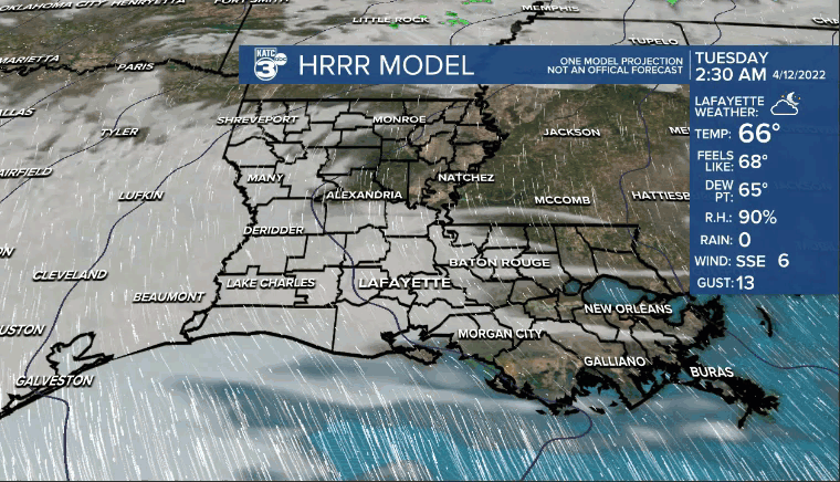
Mild tonight with overnight lows in the mid-upper 60s.
Partly to mostly cloudy skies into our Tuesday.
Expect showers and storms to increase in coverage during the afternoon and evening hours.
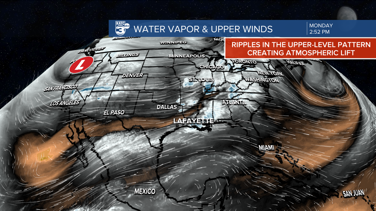
With a good amount of energy in the atmosphere, any storms that develop will have the capability to be on the strong to perhaps severe-side.
Strong winds and heavy rain will be the primary threats, but an isolated tornado can not be ruled out.
As per usual, the wild card for us is the stable marine layer which can often put a wet blanket on severe potential..
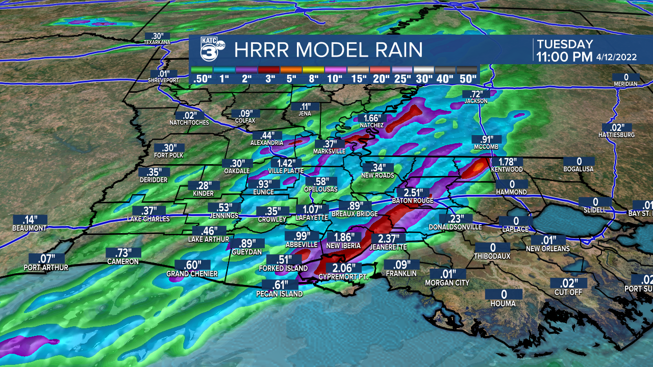
Another round of showers and storms expected into Wednesday.
Acadiana will remain locked in for a slight risk (level 2 out of 5) of severe storms.
A decent soaking of 1-2" of rainfall possible through this week
Stay with the KATC storm team for the latest.
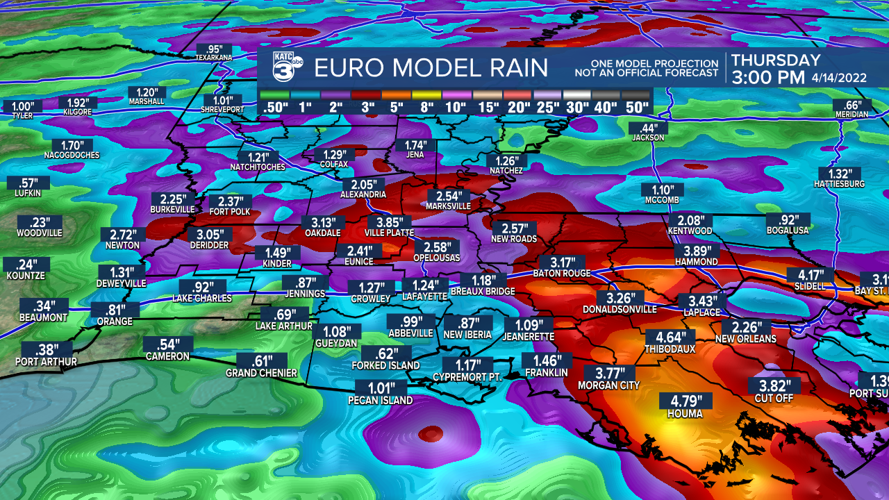
Rain chances down a bit for Thursday, but we'll see the return of scattered showers Friday.
As of now, rain chances look to tone down into the Easter weekend.
It'll be quite warm out there, as highs push the mid-80s this weekend.
------------------------------------------------------------
Stay in touch with us anytime, anywhere.
To reach the newsroom or report a typo/correction, click HERE.
Sign up for newsletters emailed to your inbox. Select from these options: Breaking News, Evening News Headlines, Latest COVID-19 Headlines, Morning News Headlines, Special Offers
