

A cloudy start to the work week, and while temperatures may be slightly cooler it's still going to be plenty muggy for the next several days.
Temperatures on Monday will push into the low 70s under mostly cloudy skies, and a light breeze coming from the northeast.
It'll be a little warmer out there Tuesday although clouds won't be going anywhere, and a few showers will be possible Tuesday night.
Tuesday night, however, is when the forecast will take a turn with an aggressive cold front moving through during the early morning hours of Wednesday.
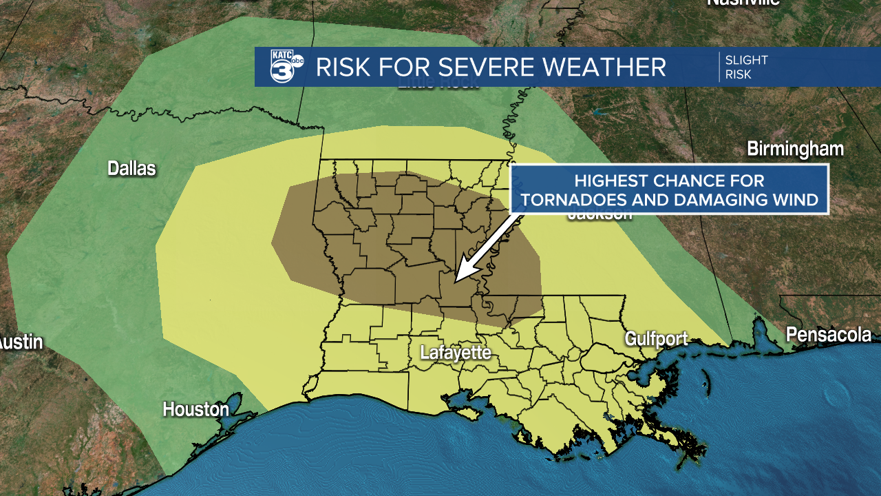
There is a chance that this front provides some severe weather, with storms capable of producing tornadoes, damaging wind, hail, and heavy showers.
Some of the stronger dynamics will sit just to our north with the greatest chance of tornadoes existing between Alexandria and Shreveport.

The front could produce a couple inches of rain over a short amount of time, so we'll need to be on the look out for some localized flash flooding.
This is particularly problematic since the front is expected to be moving through when a lot of folks are on the road for the morning commute.
Active weather will be over by Wednesday afternoon and temperatures will begin to drop dramatically, and will stay chilly through the rest of the week.
------------------------------------------------------------
Stay in touch with us anytime, anywhere.
To reach the newsroom or report a typo/correction, click HERE.
Sign up for newsletters emailed to your inbox. Select from these options: Breaking News, Evening News Headlines, Latest COVID-19 Headlines, Morning News Headlines, Special Offers
