DISCUSSION
Welcome to the weekend!
Unfortunately, it is going to be another absolute scorcher this weekend across Acadiana.
Plan on highs to push easily into the triple digits both Saturday and Sunday with heat indices also way up there.
With high pressure not directly overhead, there is the possibility of a few pop-up storms for the afternoon hours (20-30%).

On Monday, a weak front will approach the area, and that should give us a slightly better chance at some rainfall.
Although we are not going to see a drastic cool down behind the front, we should get to enjoy a reduction in our humidity for the middle parts of next week.
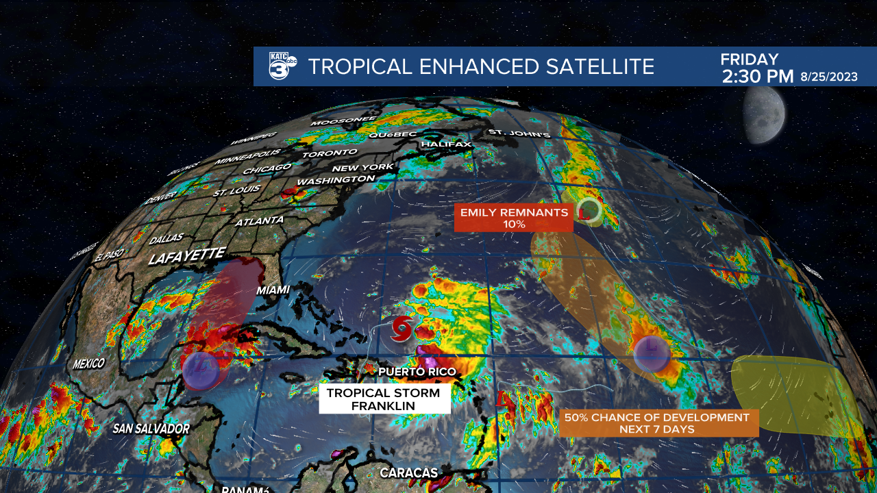
TROPICS are heating up right on cue.
Area of most interest in the short-term will be near the Yucatan as moisture pools up and a broad area of low pressure tries to develop this weekend.

This area has a high (80%) chance of developing at least into a depression in the days ahead as it tracks across the eastern Gulf.

An upper-level trough across the SE U.S. along with an associated surface frontal boundary will steer the system toward Florida by mid-next week.

It is not a threat to Louisiana nor Acadiana, but residents in Florida should monitor the progression of the system very closely in the days ahead as it will have hurricane potential.
------------------------------------------------------------
Stay in touch with us anytime, anywhere.
To reach the newsroom or report a typo/correction, click HERE.
Sign up for newsletters emailed to your inbox. Select from these options: Breaking News, Evening News Headlines, Latest COVID-19 Headlines, Morning News Headlines, Special Offers


