TONIGHT: Warm & fair
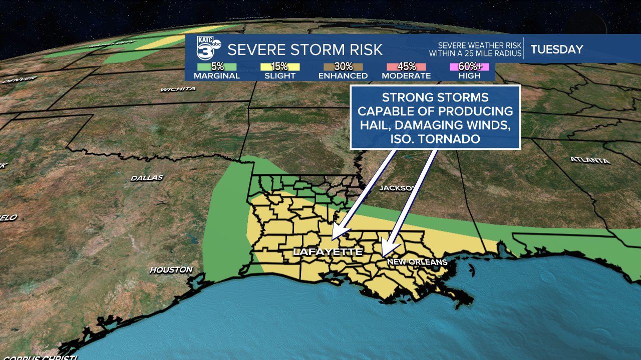
TUESDAY: Scattered storms; some strong
DISCUSSION
Well, it was another scorcher across Acadiana today.
Although it'll remain pretty hot Tuesday, we will see a better chance at some rainfall midday into the afternoon.
Some of the storms could be on the strong to perhaps severe side with damaging winds and hail being the primary threats.

Of course with any storm during the summertime, be on the lookout for heavy rainfall and lightning.

REST OF WEEK
Although it'll still be hot, the heat won't be as intense as it has been the past several days.
Expect highs to settle into the lower 90s.
We'll maintain some rain chances Wednesday-Friday, but then we'll look to turn drier this weekend and early next week as the higher heat tries to creep back in.
IN THE TROPICS
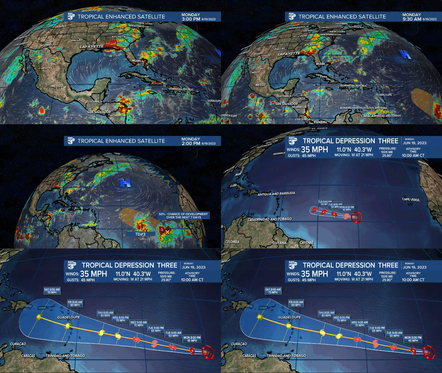
Tropical Depression Three is likely to become tropical storm Bret later on today.
It is expected to track westward with time and could become the season's first hurricane.

Models kind of dissipate it over the Caribbean down the line, but still plenty of time to watch.
Additionally, right behind it is Invest 93L.
It has a 50% chance of development in the days ahead.
If so, Cindy would be the next name up.
Regardless of any future development, the upper-level set-up across the U.S. is more supportive of a re-curve out to sea.
We'll continue to monitor.
------------------------------------------------------------
Stay in touch with us anytime, anywhere.
To reach the newsroom or report a typo/correction, click HERE.
Sign up for newsletters emailed to your inbox. Select from these options: Breaking News, Evening News Headlines, Latest COVID-19 Headlines, Morning News Headlines, Special Offers


