


Heat and humidity will remain the primary issue across Acadiana with scattered showers continuing to be a nuisance every afternoon.
There's not a whole lot of change in the short term forecast, and with the tropics heating up that is welcomed news.
Despite a tropical storm expected in the eastern Gulf of Mexico by the end of the weekend, Acadiana isn't expecting any impacts.
An abundance of moisture will remain for the weekend and most of next week as well, again not looking at any substantial changes as we go through next week.
Tropics Update:
As mentioned above there is a fair amount of activity in the tropics but it looks like for at least the next week and a half to two weeks there isn't anything likely in the Gulf of Mexico.
Things this time of year can change quickly but as of Friday, August 13th we are looking good through the later parts of the month.
All of that being said there is a new storm in the Atlantic, TD 7 will soon be Grace, and is likely headed toward the Caribbean.
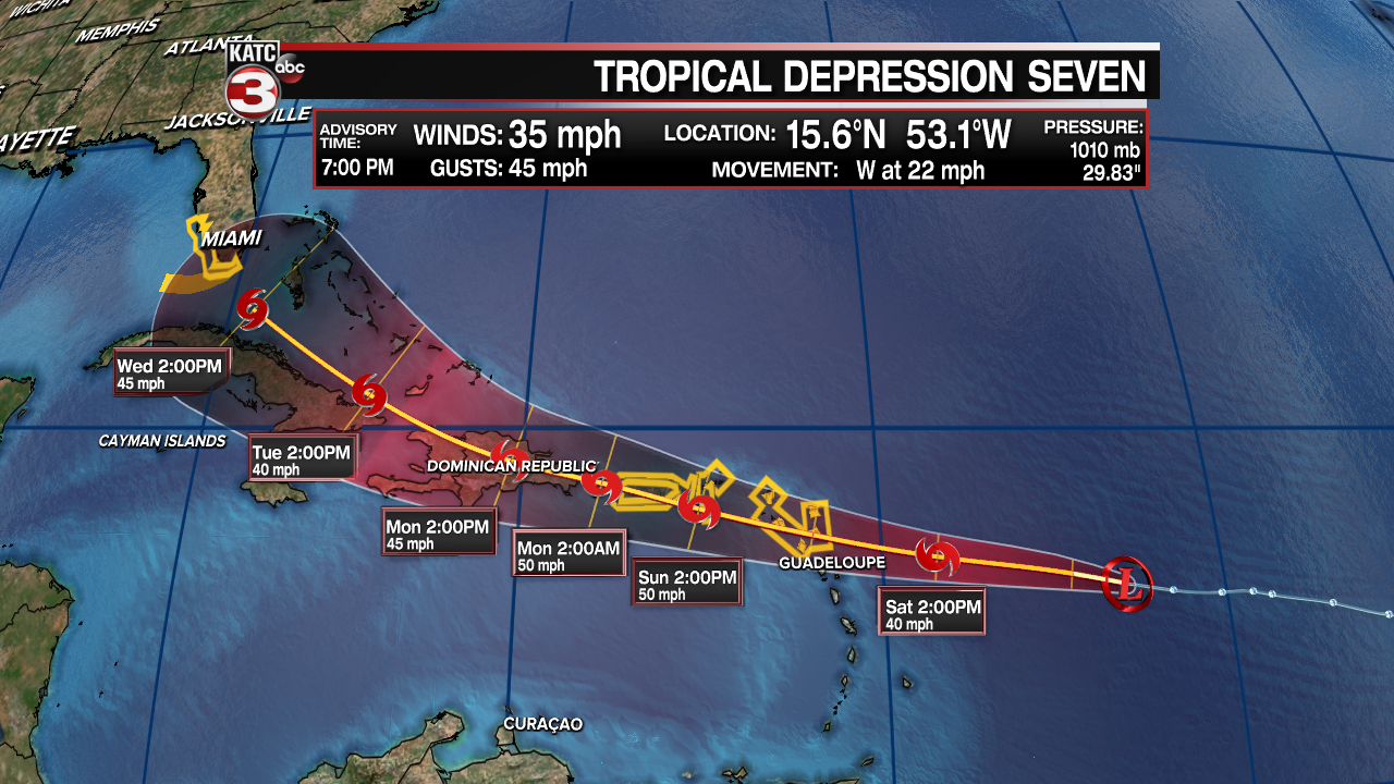
There's not much consensus regarding the intensity of the storm, with the GFS swinging wildly from run to run, but the overall track seems to be in pretty good agreement.
Despite running up through Hispaniola, a remarkably similar track to Fred in fact, Grace is believed to turn north a little quicker and move just west of the Bahamas.
As stated earlier intensity is a little up in the air right now but the NHC maintains tropical storm strength through the middle of the week.
It's early goings with this one so expect some changes to the forecast over the weekend.
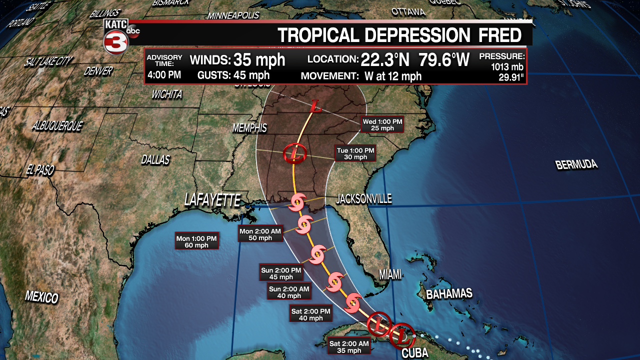
Tropical Depression Fred is the other storm that is currently being monitored, and despite looked ragged on Friday it should have a chance to get its act together and strengthen slightly.
As a tropical storm, Fred will move up the west coast of Florida and eventually into the Panhandle by the end of the weekend/beginning of next week.
Tropical showers are expected to get going in south Florida by Saturday and will then move up the Peninsula through the weekend before making landfall somewhere near Apalachicola.
Most of the impacts will be on the eastern side of the storm, and that's where you'll find not only the heavy rains but your greatest chance for spin-up tornadoes.
Showers may produce some areas of urban flooding and streams and rivers should be avoided, along with strong rip currents along the western coast.
All of these impacts will remain out of Louisiana though, but folks with interests in the Sunshine State should continue to monitor this one closely.
------------------------------------------------------------
Stay in touch with us anytime, anywhere.
To reach the newsroom or report a typo/correction, click HERE.
Sign up for newsletters emailed to your inbox. Select from these options: Breaking News, Evening News Headlines, Latest COVID-19 Headlines, Morning News Headlines, Special Offers
