


Fair skies early tonight, but clouds will be building into the area as the night wears on.
Temperatures cool in the mid-50s by morning.
Expect a mostly cloudy sky throughout our Monday.
It'll be quite windy out there with southerly wind gusts in the 30-35 mph range at times, especially during the evening.

All of this ahead of our next storm system that gets here on Tuesday.
A vigorous upper-level trough will provide the atmospheric lift and divergence aloft to support numerous showers and storms across the area.
One thing we look for when discussing severe weather potential is how the winds are changing speed and direction with height in the atmosphere.

We'll certainly have 'veering' and increasing winds with height on Tuesday allowing for storm rotation.
Furthermore, other ingredients like instability, will be in place at the surface as well.
The atmosphere will essentially be primed for severe activity across the deep south come Tuesday.
As a result, the SPC already has most of Acadiana under an enhanced/moderate risk of severe weather (Level 3/4 out of 5).
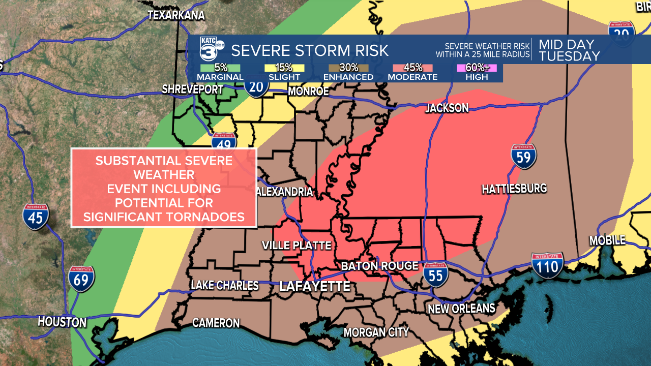
They have also been pretty strong with their wording in their discussions.
They describe it as "a substantial severe weather event including potential for significant, long-tracked tornadoes (EF2+)".
This is by no means a scare tactic, but rather simply ways to try to relay the information we have so that you can be the most prepared as possible.
The potential will be maximized in the moderate (red shading) area, but do not let that make you think that severe weather won't manifest in other areas too.
Prime-time for storms in Acadiana will be from mid-late morning and into the afternoon time frame.
Initially, we'll have to be on the lookout for individual, discreet cells out ahead of the main line of showers and storms.
These are the ones that could turn tornadic as they tap into that favorable environment.
As the main line pushes through by the afternoon, the primary concern will be damaging winds, although a couple notches in that line (QLCS tornadoes) could still be possible.
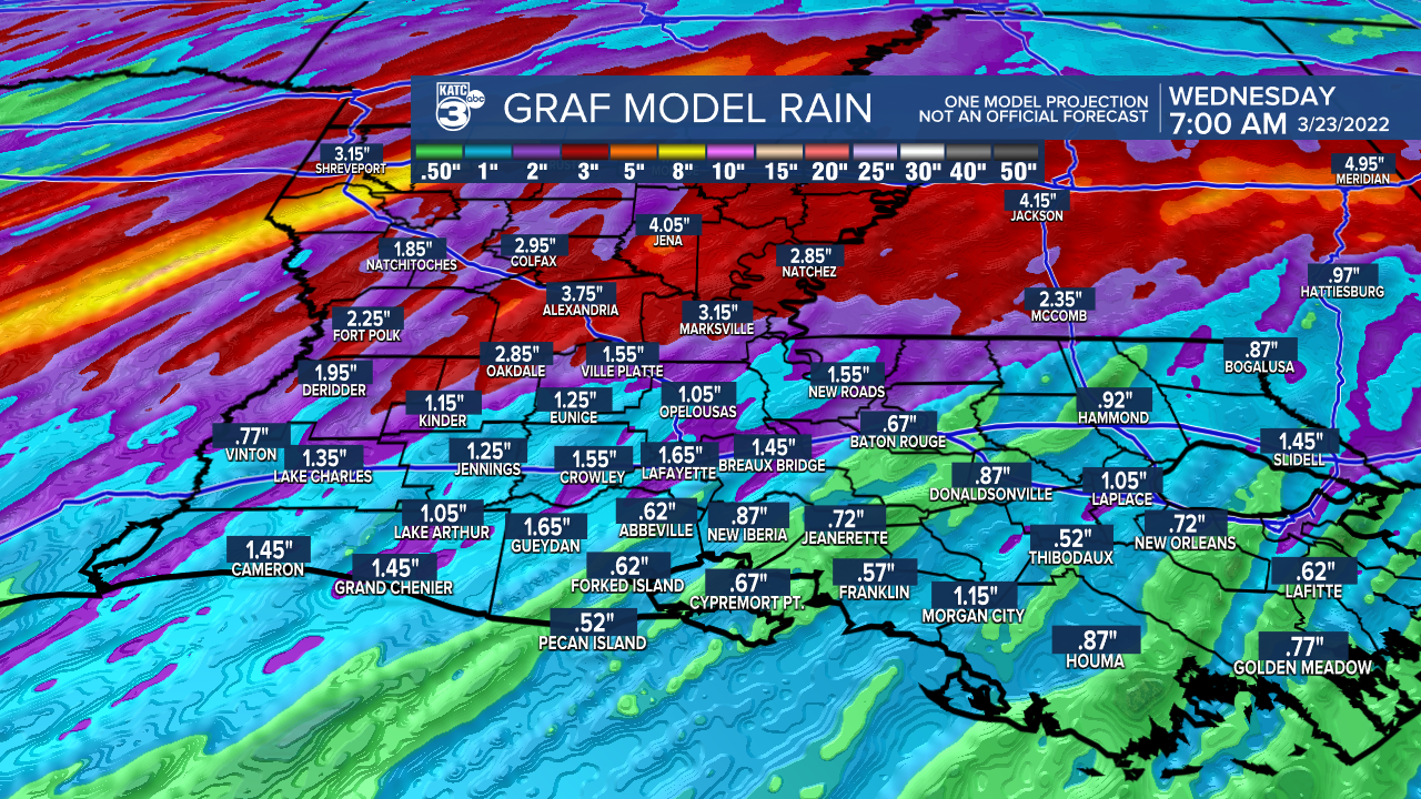
We will likely get a decent soaking of 1-2+" out of this.
All of the storms will push out of here by Tuesday evening.
It is then back to sunny and comfortable weather for the rest of the week and into the weekend.
Make sure to keep up with the forecast over the next 24-48 hours and keep it tuned to KATC for the latest.
Have a great week.
------------------------------------------------------------
Stay in touch with us anytime, anywhere.
To reach the newsroom or report a typo/correction, click HERE.
Sign up for newsletters emailed to your inbox. Select from these options: Breaking News, Evening News Headlines, Latest COVID-19 Headlines, Morning News Headlines, Special Offers
