

After an abnormally quiet season in the tropics, the Atlantic seems to have made a switch with several different areas needing some attention over the next few days.
There are currently two named storms, one of which is a major hurricane, and three other areas of interest demonstrating why you can never get complacent during hurricane season.
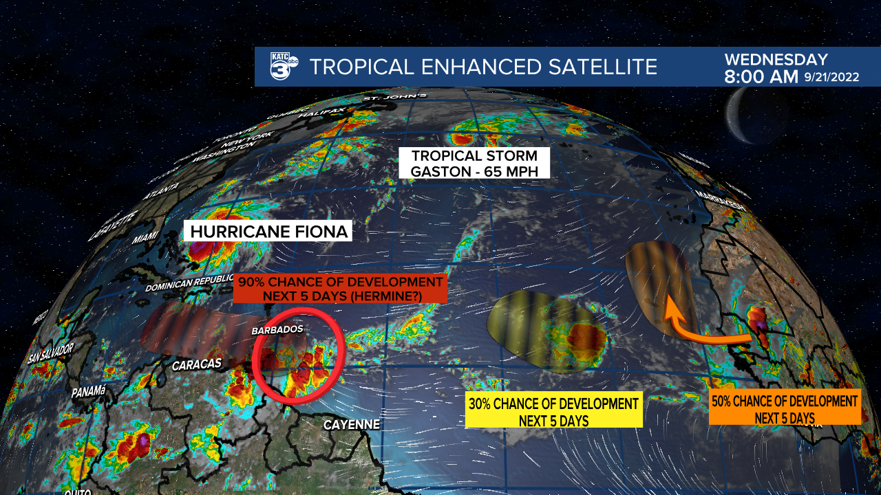
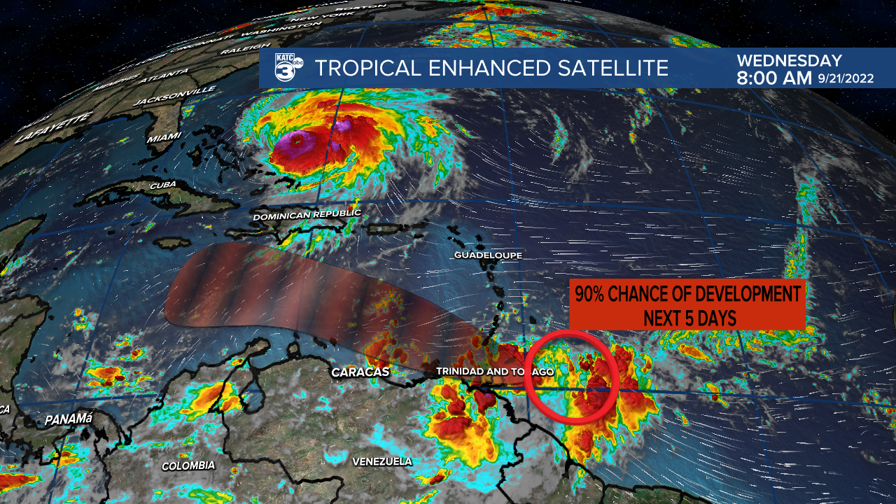
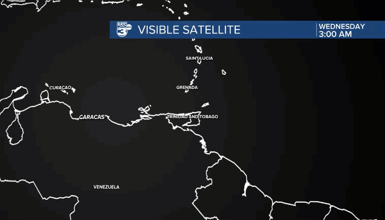
There's one area in particular that residents along the Gulf of Mexico need to monitor with a little extra diligence as the disturbance in the south Caribbean will move into an area that is prime for strengthening.
It's been battling back some northerly shear over the last day or so, which has given it a raggedy appearance and prevented a closed low from developing.
This doesn't mean, however, that it is going to fizzle out as shear is expected to diminish, and with plenty of deep warm water to tap into there won't be much that hinders it from strengthening.
Currently the National Hurricane Center gives it about a 90% chance to develop by the end of the week, and there's plenty of model support to back that up.
Before we take the time to talk models and forecast details it's important to remember how unreliable models can be before the low develops.
While all major models agree that development is going to occur and strengthening will be likely, it doesn't mean they are in lock step.
There remains big swings in timing and overall strength of the storm, which in turn impacts the reliability of predicting the direction so none of this is set in stone.
It will be important over the coming days to make sure that you are up to date on the latest information and to make sure that information is coming from reliable sources.
As long as that caveat is kept in mind we can dive into what the forecast is telling us now, and what to look for in the coming days.
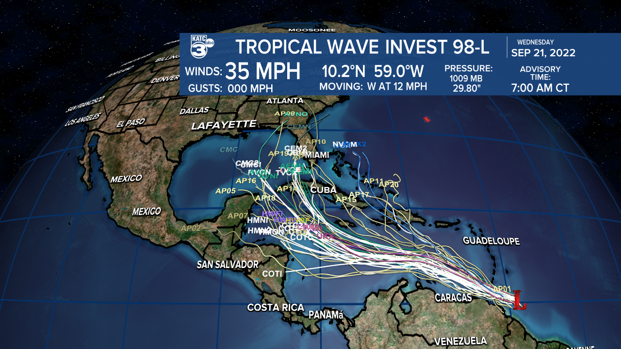
Models have pretty consistently brought the storm into the eastern Gulf of Mexico, although there remains a tremendous amount of uncertainty regarding how far west it will drift.
The last 24 hours have shown landfall between the western Florida Panhandle all the way down to Key West, this doesn't mean that the central or western Gulf Coast is out of the danger zone just yet.
Some of this inconsistency will start to iron itself out as we get a fixed position on the low, but until then anticipate some guess work from the models and in turn a changing forecast.
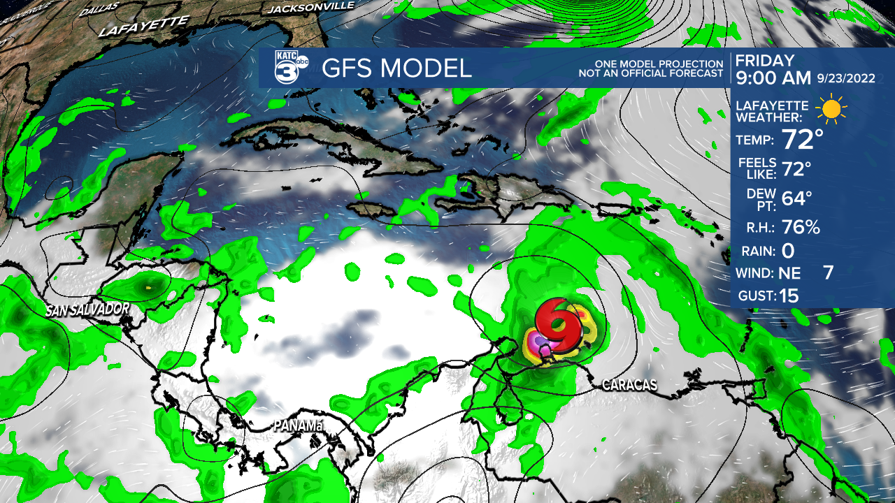
The GFS continues to strengthen this wave quickly, hinting that we may see a closed low as early as Thursday which would likely trigger the National Hurricane Center to begin issuing advisories.
It remains to be seen if Invest 98L will develop that quickly, it lost some of its organization after dealing with some shear for the better part of the day, so it would really need to start coming together to strengthen as fast as the GFS is indicating.
There continues to be some shear to the north and some land interaction to the south, so development isn't likely to occur on Wednesday, if we see it start to come together on Thursday it may build a little more confidence into the GFS solution.
The EURO solution looks, a little different though keeping the storm as an open wave through the week and into the weekend, finally developing a closed low on Sunday and starting the strengthening process.
Compare the below graphic to the snapshot of the GFS, when the GFS initializes the low the EURO is still very much just a cluster of thunderstorms.

So it we're getting into the weekend and it looks like we still have an open wave it will lend a little more support to the EURO solution , but keep in mind these models will run another ten times before the end of the week, potentially producing 10 different solutions.
Where we do see a little consistency is both models seem to favor the eastern Gulf of Mexico, with the GFS drifting further west and still very much in a region that should cause us to pay close attention.
It is largely going to depend on a front that is expected to slide down into south Louisiana early next week, and that front should help keep the storm out of the region.
Again, though, we are looking at a 6-8 day time frame, and if the front arrives a little slower it could allow the storm to drift further west, so again we can't get complacent.
Most of this article is focused on the development of the low, and the reason is that's really the key piece to all of this, everything else beyond that is just to uncertain to say with a great amount of confidence.
As we learn more about this potential storm we can start to narrow down the areas impacted, and the last thing we'll iron out is specific impacts.
This part of the forecast process can be frustrating because there's still more questions than answers but the truth is that's the nature of forecasting.
------------------------------------------------------------
Stay in touch with us anytime, anywhere.
To reach the newsroom or report a typo/correction, click HERE.
Sign up for newsletters emailed to your inbox. Select from these options: Breaking News, Evening News Headlines, Latest COVID-19 Headlines, Morning News Headlines, Special Offers
