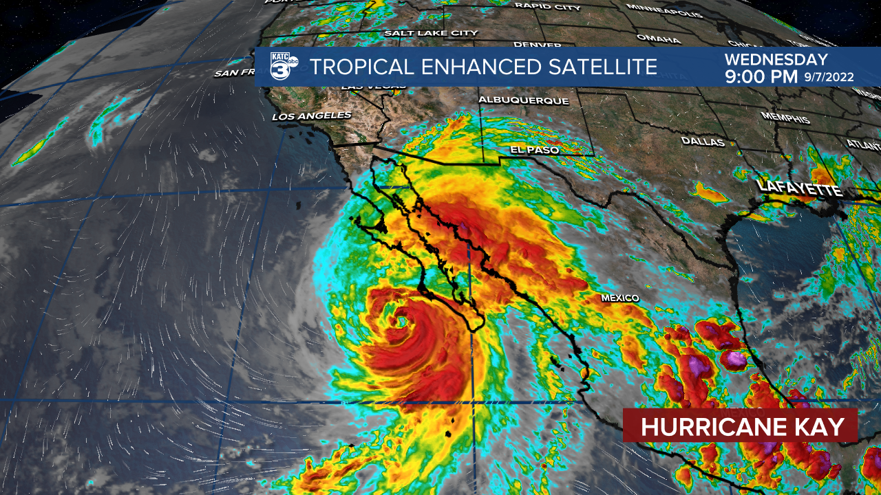

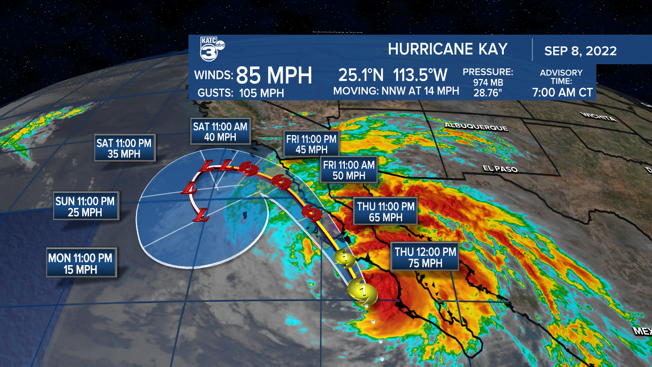
It doesn't happen often, but a tropical system is likely to affect much of western Mexico, and flooding rains are possible over southern California. Hurricane Kay is currently (as of 7am Thursday) near the Baja California peninsula in Mexico with winds of 85mph. The track pushes Kay northward along the Pacific coast before weakening and moving away from the coast.
It could be the closest approach of a tropical system to California in more than 25 years. Hurricanes and tropical storms normally die out before moving that far north. The reason, a cold current of water flows from Alaska, southward along the west coast. Many non-natives are shocked when they head to the beaches of southern California and find water temperatures below 68 degrees, even in the middle of summer. Hurricanes and tropical storms need water temperatures of at least 80 degrees to survive.
The only known tropical system to reach California is the San Diego Hurricane of 1858 where heavy rains, and winds up to 80mph caused significant damage and flooding.
Kay is expected to bring breezy conditions to San Diego, Orange, and Los Angeles Counties, with heavy rains possible over the desert region east of the urban areas. Parts of California from the Mexico border, northward to Palm Springs, could see up to six inches of rain.
