

Thursday's forecast isn't a major deviation from what we've had for the majority of this week.
A cloudy morning will eventually give way to some afternoon sunshine as temperatures crawl into the low 80s.
Winds are going to be a little gustier coming out of the south around 10-15 mph, with some gusts that are a little higher.
Despite afternoon sunshine clouds will be returning to the forecast late Thursday night, and this time will stick around into Friday.
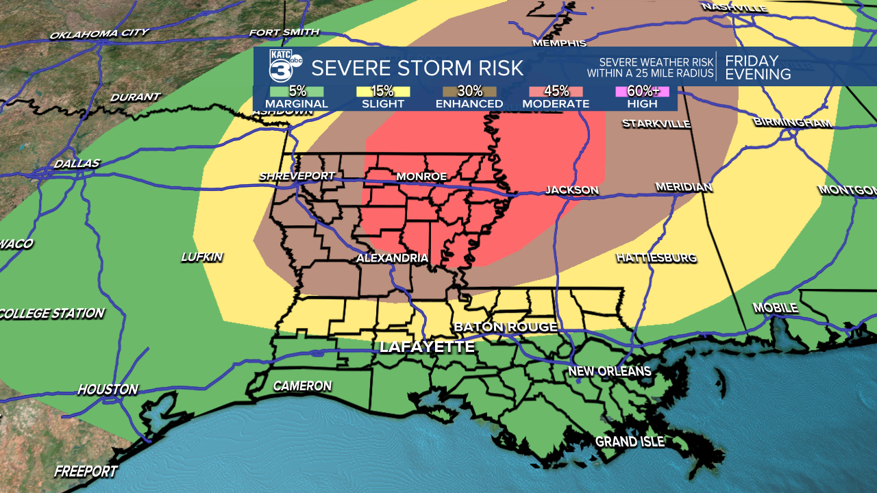
Friday is when the forecast becomes much more complicated as strong, violent storms will be possible in portions of Louisiana.
Models have slowly indicated a shift in the strongest storms being just north of Acadiana, with a focal point in the tri-state area of Mississippi, Arkansas, and Louisiana.
The SPC has actually reduced Acadiana's risk for severe weather, moving areas from the I-10 corridor to the south into the Marginal Risk category, while keeping north Acadiana in the Slight Risk category.
There's enough ingredients in place in Acadiana to be mindful of potential severe weather, but the strongest dynamics will be in the northeast corner of the state.
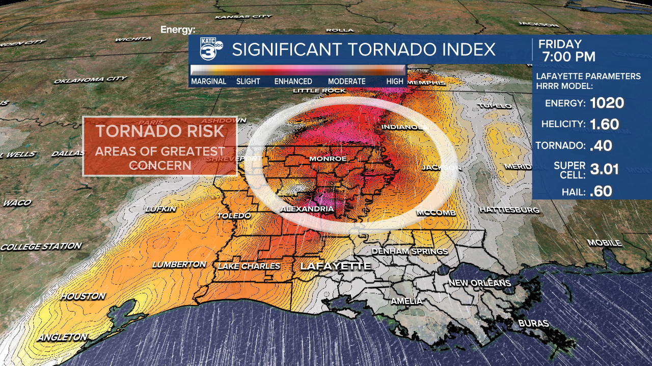
The surface low will track through southern Arkansas which will act as the forcing mechanism to kick off the storms, but Acadiana won't have that same trigger.
Storms in our region will have to largely rely on daytime heating, which will be limited due to the layer of clouds will deal with through most of the day.
That being said anything that gets going, no matter how isolated, will need to be monitored closely since conditions will be favorable for rapid development.
A forecast like this is tough to plan around because it relies so much more on luck, and if you're the unlucky person who saw the one strong storm in the evening; but the best course of action is to always be mindful when there's a set up like the one we have Friday.
If we do get strong storms they would most likely be in the late afternoon and early evening, so before your final commute of the week it wouldn't be a bad idea to take a look over at the radar.
As always this is an ever evolving forecast but as it changes we'll be sure to get the latest information out to you as fast as possible.
The good news is that this will clear out by Saturday and we'll get a brief round of sunshine before showers and clouds return on Sunday.
------------------------------------------------------------
Stay in touch with us anytime, anywhere.
To reach the newsroom or report a typo/correction, click HERE.
Sign up for newsletters emailed to your inbox. Select from these options: Breaking News, Evening News Headlines, Latest COVID-19 Headlines, Morning News Headlines, Special Offers
