

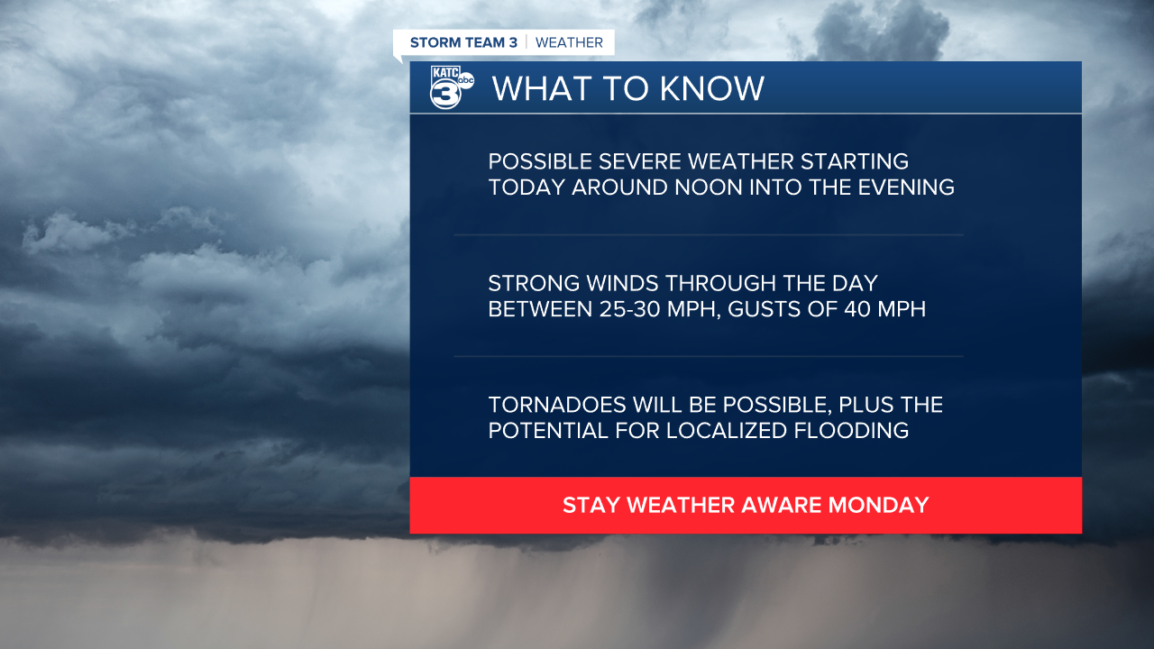
The work week will get started with a chance for some severe weather across Acadiana.
Acadiana's window for severe weather will open around noon with scattered storms popping up during the early afternoon.
These early storms won't be as organized but will still have the potential to develop into supercells or produce hail, damaging winds, and isolated tornadoes.

The tornado risk will be highest in the south eastern corner of the state where dynamics will be a little stronger, that being said, tornadoes will be possible across all of Acadiana.
While thunderstorms will start to arrive around noon, it looks like most of the tornado ingredients will start to come together later in the day, followed by a line of storms in the evening.
This means that we'll have to remain vigilant for an extended portion of the day, and the severe weather threat likely won't diminish until closer to midnight.

Winds are going to be an issue through the day, regardless of whether there are storms in your area, as they'll be sustained about 25-30 mph with gusts pushing 40-45 mph.
That's strong enough to pick up some debris or knock loose some dead branches from trees and in turn could lead to a few power outages.
Heavy rainfall will continue through the afternoon with areas picking up 2-4" of rain on average and 5-6" in hotspots.
Flash flooding could become an issue as the rain piles up, especially during the evening commute so make sure that you have a few different routes to get home.

Conditions will improve overnight as temperatures take a sharp drop by Tuesday morning, with lows down in the 40s and wind chill in the 30s.
Winds will remain elevated through the day on Tuesday which will keep things feeling very chilly despite the abundance of sunshine.

It looks much quieter through the mid week but another round of showers will creep into the area by the end of the week.
This is all pretty typical of an El Nino pattern so expected rounds of wet weather to persist through the winter months.
At least it will help dig us out of drought.
------------------------------------------------------------
Stay in touch with us anytime, anywhere.
To reach the newsroom or report a typo/correction, click HERE.
Sign up for newsletters emailed to your inbox. Select from these options: Breaking News, Evening News Headlines, Latest COVID-19 Headlines, Morning News Headlines, Special Offers
