


After a winter chill through Wednesday morning, Acadiana can expect a gloomy and wet period to follow later this week, which will likely carry through the entire weekend.
In the near term, high pressure advancing in (and air traveling over some snow covered areas in the mid-Mississippi Valley) will conspire to keep January-like temperatures in the area through Wednesday.
Look for temperatures overnight through Tuesday morning to reach down into the mid-upper 30s.

Some patchy frost may be possible for some in the extreme northern Acadiana parishes into Central Louisiana.

It will be another nice, sunny and cool winter-like day Tuesday with highs reaching the lower 60s in most areas.
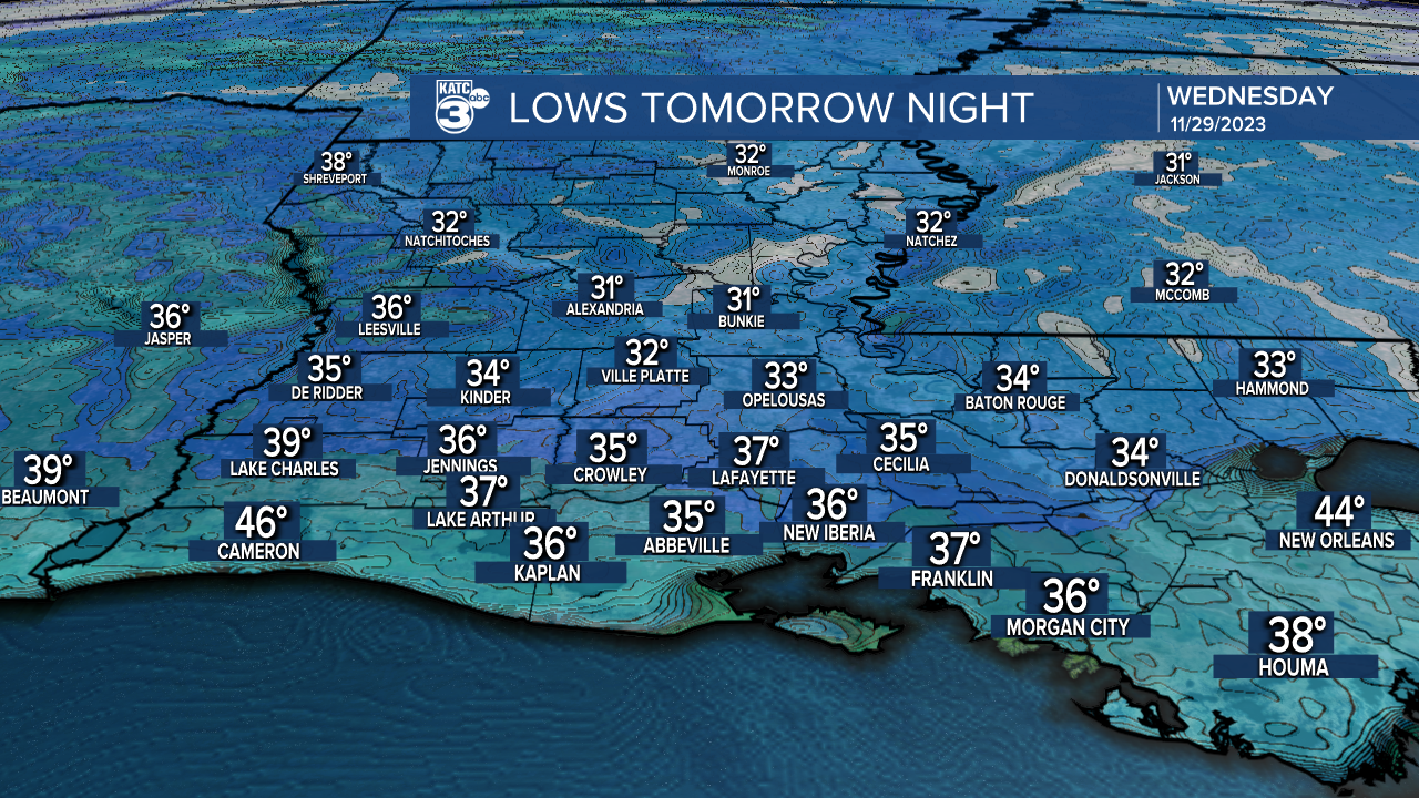
The coldest temperatures of the week should arrive Tuesday night into Wednesday morning, with lows dipping down into the low-mid 30s.
Frost may be likely for most parishes, especially along and north of the I-10 corridor, so take care the the tender vegetation and the pets.

A huge turn in the local weather pattern arrives by Thursday as a strong upper impulse approaching from the west interacts with the sub-tropical jet stream to produce rain and embedded thunderstorms with a few inches of rain possible.

But wait there's more, additional disturbances and an active sub-tropical jet will keep clouds and rain chances, Friday into the weekend.
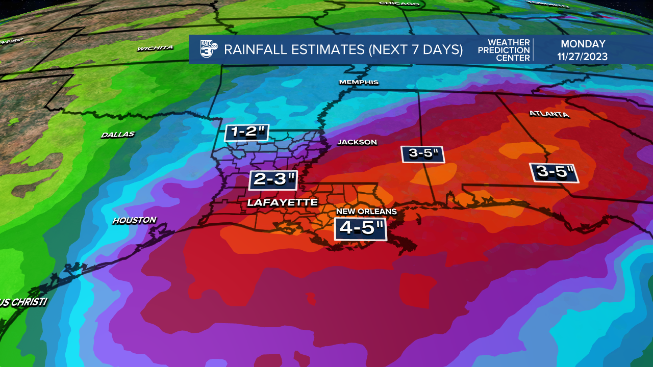
Rainfall totals over the next 7 days per the Weather Prediction Center are in the 2-4" range for the Acadiana area, with the highest amounts near the closer to the coast and to the southeast.
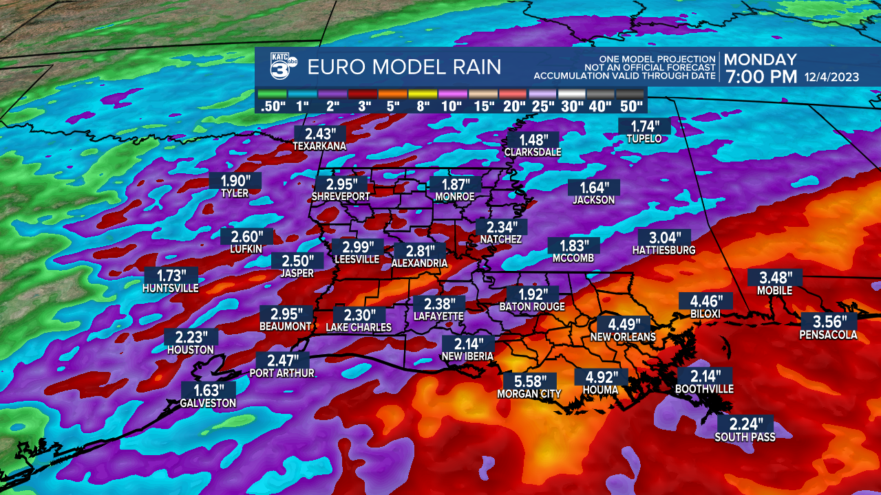
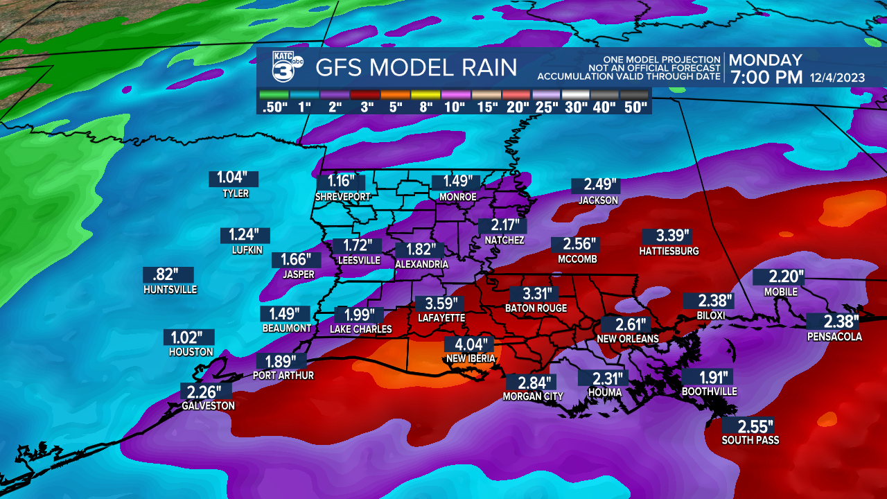
Today's models are in the same ballpark with regards to rain totals over the next week, with the GFS model wetter than the Euro.
No severe weather is expected locally, but some hefty thunderstorms, enhancing locally heavy downpours will be possible...which in turn could lead to some localized street flooding.
Better than normal rain chances will remain in the area the weekend, perhaps through Monday, before we get a stretch of some nice cool days next week.
See the KATC 10 Day Forecast for the latest.
------------------------------------------------------------
Stay in touch with us anytime, anywhere.
To reach the newsroom or report a typo/correction, click HERE.
Sign up for newsletters emailed to your inbox. Select from these options: Breaking News, Evening News Headlines, Latest COVID-19 Headlines, Morning News Headlines, Special Offers
