

The last few weeks have been busy in the tropics, August so far has produced three different named systems, and the recipe is there to see a fourth before we turn the page into September.
Given some of the latest model projections and National Hurricane Center guidance it seemed like a good idea to talk about what we know, and equally important what we don't know.
We can start with a brief mention of a wave that is currently in the Atlantic Basin, the NHC gives is a small chance to develop into tropical system and if it does it will remain in the central Atlanic.
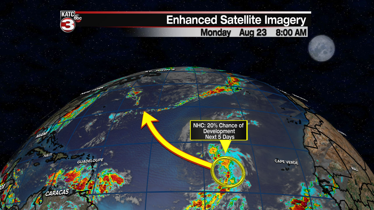
This, obviously, poses no threat to Acadiana and is mentioned only because this is a comprehensive look at the entire Atlantic Basin.
There is an area closer to home though that should be monitored over the next couple of weeks as it seems to be a spot that is primed for producing tropical weather.
An area off the coast of Honduras has been an area that computer models have continuously projected some form of tropical development occurring, and that has certainly caught the eye of forecasters.
There's been enough consistency in the various model runs to warrant a closer look, and the NHC has certainly indicated that they are indeed watching this spot closely.

It is important to keep in mind that there is no actual feature there now that you can point to and expect it to flare up into something bigger, and until there is an actual thunderstorm cluster or low the forecast will be a little more uncertain than we'd like.
The reason for mentioning it as an area of interest though is because the ingredients are present for tropical development and there's been some remarkable consistency from some of the models.
In this article we'll focus on the GFS has it has been slightly more reliable with regards to the tropics both last season and so far this year, but remember just because it is on the GFS does not mean it is set in stone.

While development in that part of the world needs to always be watched it does look like a building ridge over the weekend will once again keep any tropical activity to the south, similar to the track that Grace took this past weekend.
Models continue to look active through the next few weeks, and if they are to be believed the Gulf of Mexico will again need to be on alert for Labor Day weekend, but since that forecast is so far out in the future there's little value in cherry picking various image models to display.
It should come as no surprise though that models are bullish on tropical activity as we are now firmly in the absolute peak of hurricane season for storm making landfall in Acadiana.

The purpose of this post isn't to scare and alarm anyone, in fact it shouldn't even really come as much of a surprise to those of us who have been along the Gulf Coast.
Through the next few weeks we'll need to keep a close eye on the tropics, and make sure that our hurricane plans are all up to date.
Remember that forecasts are never set in stone, and the outlook today may not be the same as the outlook tomorrow.
So stay vigilant these next few weeks as the tropics really start to heat up.
------------------------------------------------------------
Stay in touch with us anytime, anywhere.
To reach the newsroom or report a typo/correction, click HERE.
Sign up for newsletters emailed to your inbox. Select from these options: Breaking News, Evening News Headlines, Latest COVID-19 Headlines, Morning News Headlines, Special Offers
