


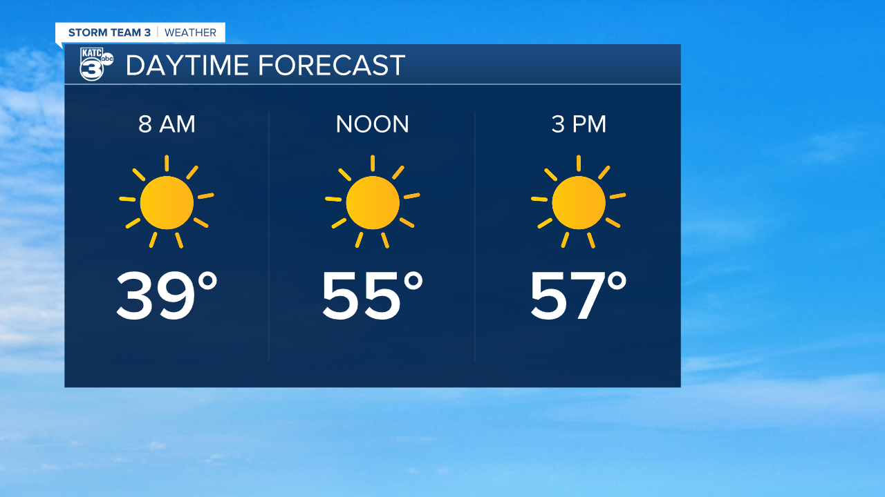
After a fairly dreary weekend the sun will be out in full force to start the week, although temperatures will stay chilly for another day.
Monday is off to a frosty start but temperatures should eventually crawl into the low 60s by the end of the afternoon, with a very light breeze coming in from the north.
Skies will remain clear overnight and lows will drop into the upper 30s, with frost possible again by early Tuesday morning.
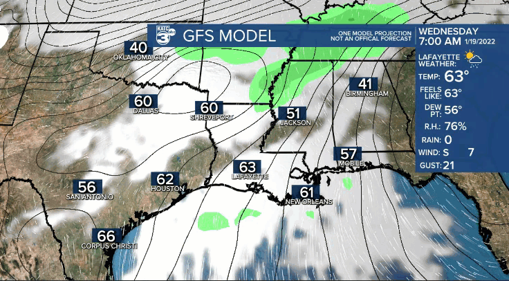
We should warm up through the next few days and highs will be back in the upper 60s on Tuesday and even into the upper 70s by Wednesday afternoon.
The forecast won't remain quiet for long, however, with our next front making its push across the region Wednesday evening.
This means showers and thunderstorms will roll in late Wednesday and will likely stick around into Thursday, with clouds and showers continuing on into Friday.
The front looks like it will stall just offshore for the end of the week, keeping the clouds and threat for rain in place for the second half of the week.
It doesn't look like we will get the cold and the precipitation to line up to produce any kind of wintry precip. but we'll be close so it'll be something to monitor over the next couple of days.
While clouds will start to clear over the weekend, temperatures look like they will stay cold into next week.
------------------------------------------------------------
Stay in touch with us anytime, anywhere.
To reach the newsroom or report a typo/correction, click HERE.
Sign up for newsletters emailed to your inbox. Select from these options: Breaking News, Evening News Headlines, Latest COVID-19 Headlines, Morning News Headlines, Special Offers
