More summertime heat to begin the work week with highs in the mid 90s and feel like temperatures topping out near 103° Monday afternoon.

With the heating of the day a stray afternoon shower will be possible Monday but most of Acadiana should stay dry.
A similar forecast on Tuesday with highs near 94° and heat indices in the triple digits.
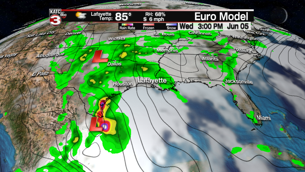
By Wednesday a few scattered showers or storms will be possible as the leading edge of some tropical moisture begins to make its way into South Louisiana.

With the chance for rain and a fair amount of clouds that should prevent temperatures from getting too hot as highs should stay in the upper 80s to near 90 Wednesday afternoon.
Thursday will be our best chance for widespread showers and storms, especially during the afternoon and evening as a tropical low slides over Acadiana.

Models have a hard time figuring out the moisture efficiency of these tropical lows but 1-3 inches is a good bet while a few localized spots could get as much as 3-5 inches meaning a couple communities might have to deal with flash flooding.
The low should lift out of the area by Friday morning but as the system works its way towards the Tennessee Valley a few isolated showers will be possible Friday afternoon with the heating of the day.
Heading into next weekend the sunshine and heat returns with highs back into the low to mid 90s and with a few places still drying out from the possible heavy rains on Thursday a few afternoon pop-up showers will be possible both Saturday and Sunday but rain chances will only be around 10-20%.
As for the area of tropical moisture in the Bay of Campeche the system remains fairly unorganized as it does not have any upper level support.

However the National Hurricane Center is still giving the tropical wave a 60% chance of development in the coming days as it slowly moves to the northwest towards the East coast of Mexico.
Whether it become a depression or not this slug of tropical moisture will still bring heavy rains to much of eastern Mexico and then up the Texas coast before giving us a good soaking on Thursday.

