
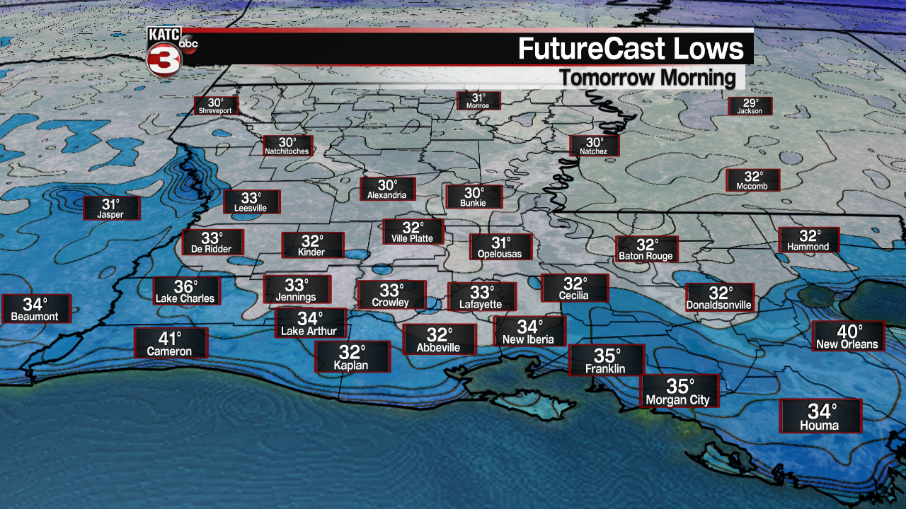
It’s time once again in Acadiana to cover the plants and make sure the pets have a warm place to stay overnight through Tuesday morning, as temperatures will be near the freezing mark at daybreak.
No need to worry about the pipes…and milder conditions are expected for the rest of the week and into the weekend for sure.
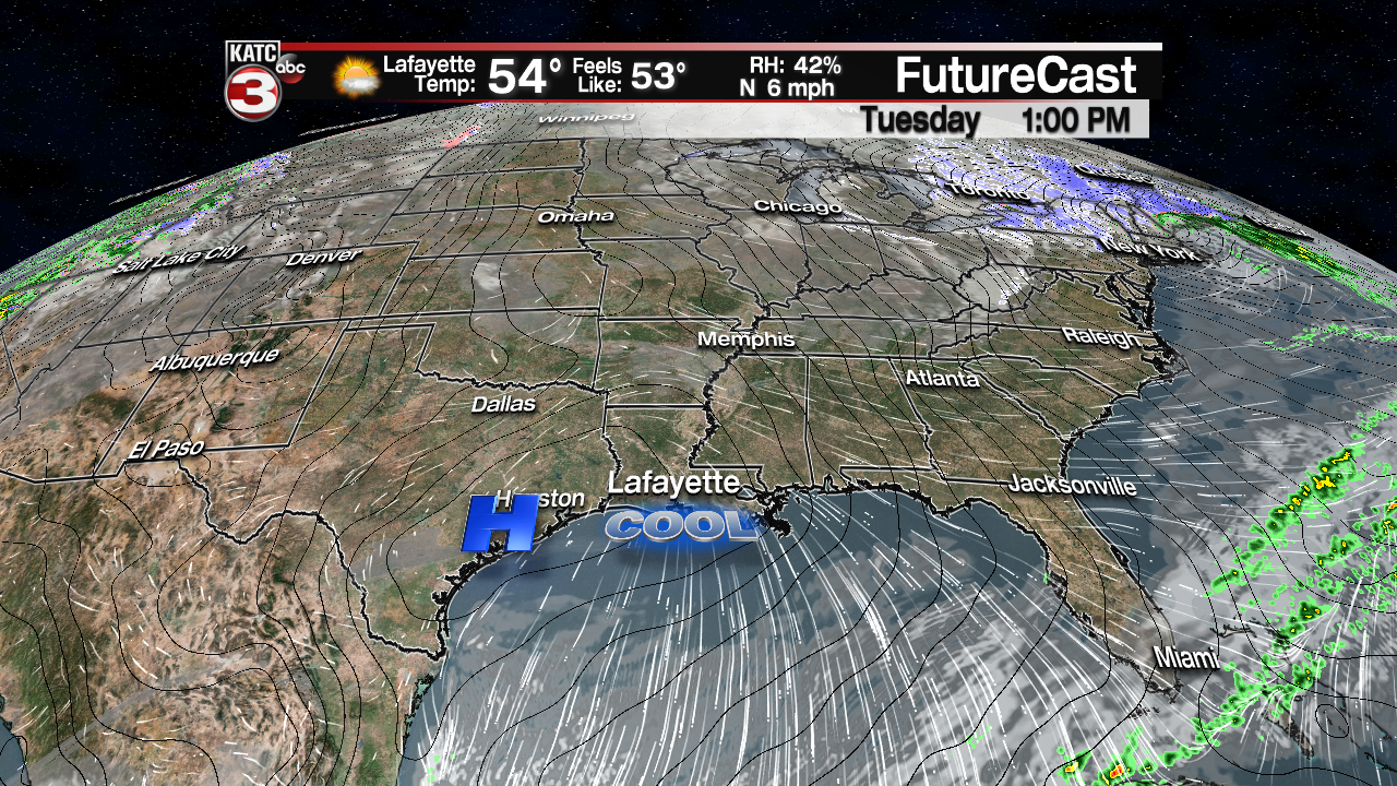
After frosty Tuesday, expect lots of sunshine and light N/NW winds to allow temperatures to rise into the mid-upper 50s…similar readings to Monday’s afternoon temperatures, minus the wind, which will make it feel milder in the sun.
Another chilly night is on tap for the area Tuesday night into Wednesday morning, but it shouldn’t be quite as cold with lows across the area likely ranging in the mid-upper 30s…nonetheless, a light frost could be possible for some Wednesday morning.
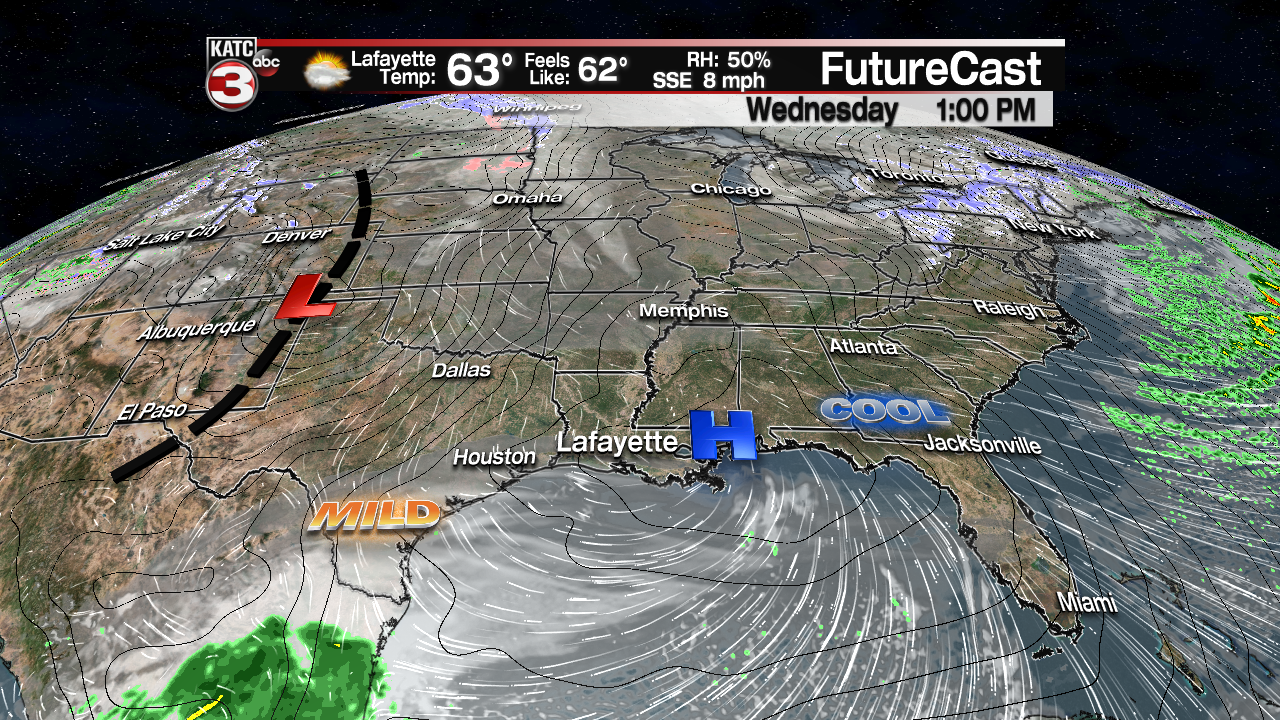
Milder temperatures in the 60s are anticipated Wednesday afternoon with southeasterly winds, and partly sunny skies with plenty of high level cirrus clouds to help dull the sun.
Change will be on the way for the end of the week as our next weather-maker is taking shape for Friday, per the latest European Model.
First, expect mostly cloudy skies and a warm front Thursday that may generate a few brief, scattered showers, followed by temperatures rising into the low-mid 70s.
A powerful and large, slow-moving storm system rolling out of the Rockies into the High Plains late this week may bring an excellent chance of showers and storms Friday (for now I have rain chances at 70%…but that number may go up as the week wears on).
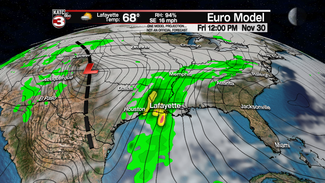

While still early in the game, there will be the chance of some locally heavy rains of several inches and perhaps a severe weather threat with the storms Friday. The Euro Model is very liberal with the rainfall Friday, while the GFS model is not.

You can see the latest long range guidance below:
 European Model Forecast Day 1


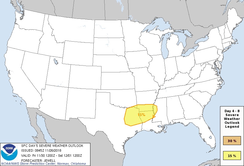
And per the Storm Prediction Center “Day 5 Outlook” concerning the severe weather potential, “Rapid height falls and a low-level jet increasing to 50 kt will favor severe thunderstorms mainly Friday evening and overnight from eastern TX into LA and AR.”
This means there could be a few severe storms that could contain damaging winds and a few tornado spin-ups, especially areas northwest of Acadiana toward the Arklatex.
So stay tuned for developments with our Friday/Friday night weather system.
After the stormy conditions Friday, and perhaps a few lingering showers and/or fog Saturday morning. Dry westerly winds will warm the region quickly, and if we do get the expected sunshine Saturday afternoon, temperatures could reach the lower 80s!
Cooler conditions will gradually filter into the area Sunday with another shot of colder air moving in for a good part of next week.
See the latest KATC 10 Day Forecast for the latest.
